News
‹ back to weather news
News
-
Record run of winter days above 30°C for Brisbane
Ashleigh Madden, 27 August 2024Brisbane could see a record-breaking run of winter heat this week, with the mercury reaching at least 30°C for six days from Wednesday. The heat will peak on Saturday, with the mercury challenging 35°C in the afternoon.
Temperatures will reach around 8 to 10°C above average across a large area of southern Qld, including Brisbane on the three days from Thursday, August 29.
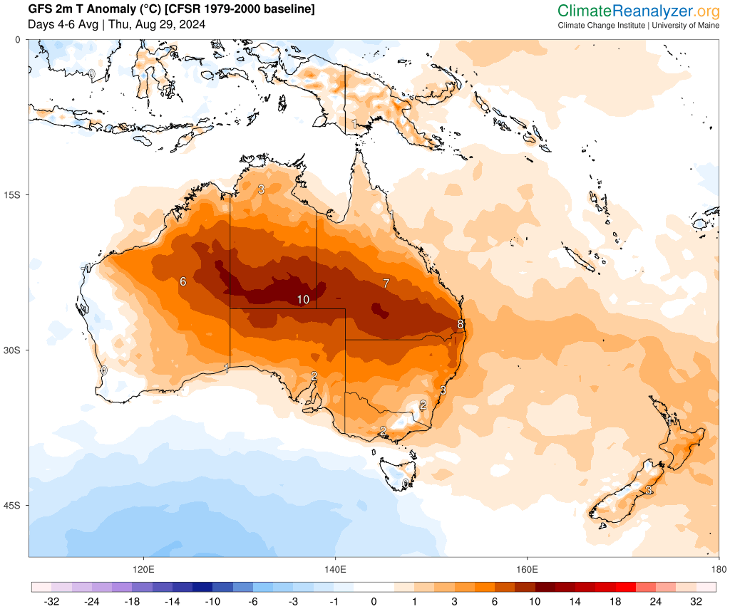
Image: 2m temperature (°C) anomaly for three days from Thursday, August 29. Source: ClimateReanalyzer.org
This warmth is being caused by an unseasonably warm airmass lingering over central and northern Australia, in response to a stubborn high pressure system and prevailing warm and dry westerly winds as a series of cold fronts sweep across southern Australia.
The map below shows a warm airmass around 1.5km above the surface over WA, the NT and Qld, making it all the way offshore southeast Qld, as westerlies drag the heat all the way to the coast on Saturday.
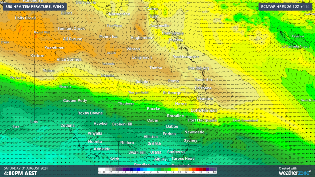
Image: 850hPa temperature and wind on Saturday, August 31, according to ECMWF
This pattern could bring Brisbane’s warmest winter run since records began in 1887, with six days at or above 30°C on the forecast between Wednesday and Monday next week.
The longest run that the city has seen during a previous winter was during August 2009, when the maximum temperature reached or above 30°C for three days in a row.
The hottest day of the week will be on Saturday, August 31, when Brisbane’s temperature could reach 34 to 35°C, while Archerfield to the west of Brisbane could reach 36 to 37°C.
Luckily this heat will not be mixed with humidity, with warm and dry westerlies most likely keeping the sea breeze out.
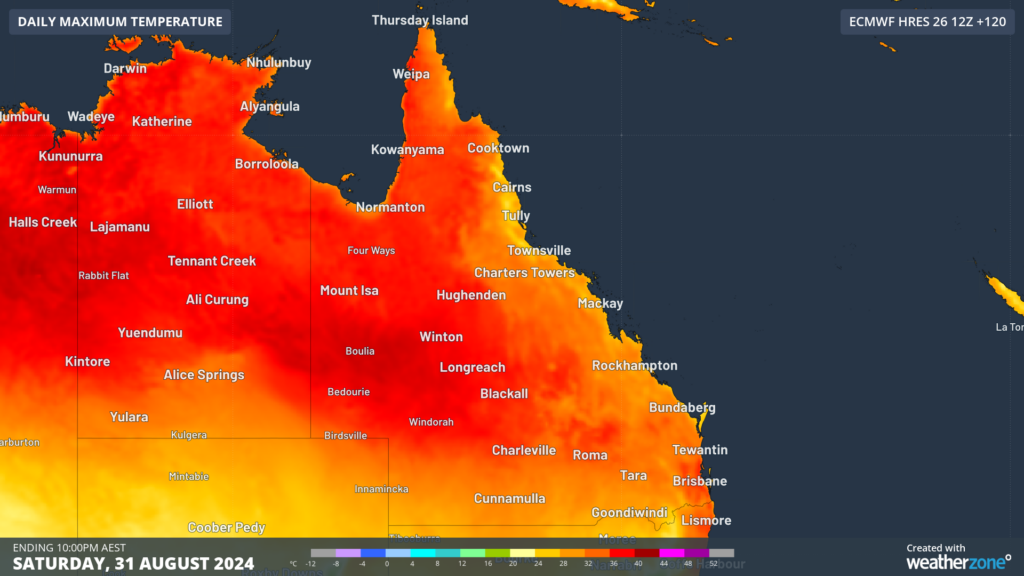
Image: Maximum temperature forecast for Saturday, August 31, according to ECMWF
The minimum temperatures will also be nearly 7°C above average for three nights beginning Friday, with the temperature only dropping to 18 to 19°C.
Looking ahead, the temperatures should finally drop into the 20’s from Tuesday, September 3 as the high pressure system moves further east directing a cooler northeasterly flow over the city.
- Other news
- Fri 13 Sep 2024 Cold snap to hit five states this weekend
- Fri 13 Sep 2024 Snowmaking system saves American ski resort from wildfire
- Thu 12 Sep 2024 Atmospheric gravity waves spotted off Australia's northwest coast
- Thu 12 Sep 2024 More than 100 thousand lightning strikes lashed northwest WA this week
- Thu 12 Sep 2024 This weekend's AFL and NRL footy finals weather