News
‹ back to weather news
News
-
More than 100 thousand lightning strikes lashed northwest WA this week
Ashleigh Madden, 12 September 2024It’s been a very active thunderstorm week in the Pilbara and Gascoyne region, with thousands of lightning strikes detected in the region.
The thunderstorms were triggered by a near-stationary trough sitting along WA’s west coast, paired with an unstable airmass and unseasonably warm conditions.
The images below show the lightning strikes (pink), cloud and rain on Wednesday evening, September 11.
Image: Himawari-9 satellite image, rain and lightning strikes for the four hours leading up to 9pm on Wednesday, September 11
Weatherzone’s Total Lightning Network detected 113,178 strikes within 500km of the Pilbara between Sunday and lunchtime Thursday, September 12.
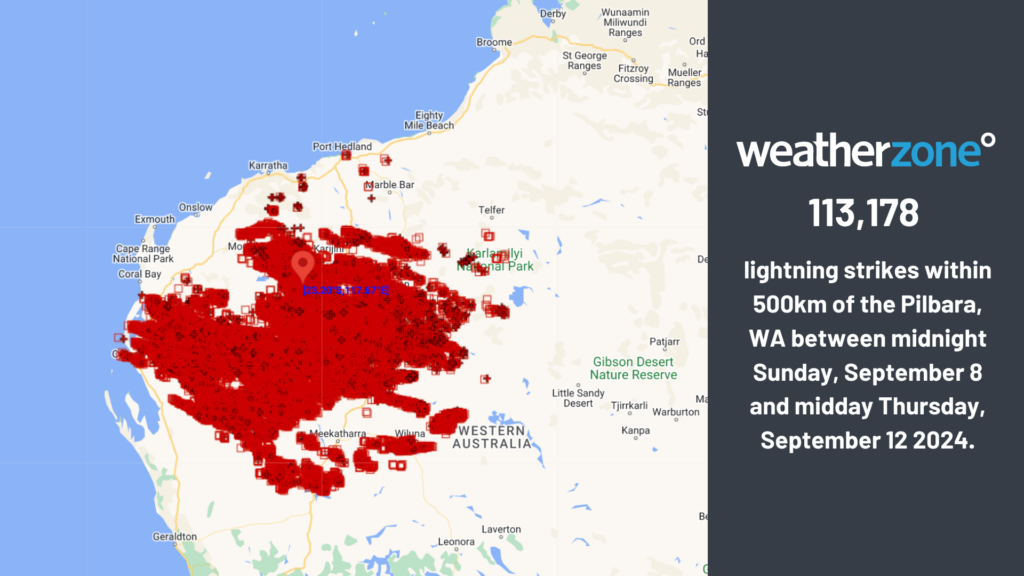
The most active storm day of the week was Wednesday into Thursday morning, with 53,859 strikes detected in the region in just 36 hours.
During this week so far, 25 to 50mm fell in parts of the Pilbara and Gascoyne districts in these thunderstorms. Mount Vernon in the Gascoyne saw 40mm fall in 48 hours, which is more than 14 times their September average of 2.8mm.
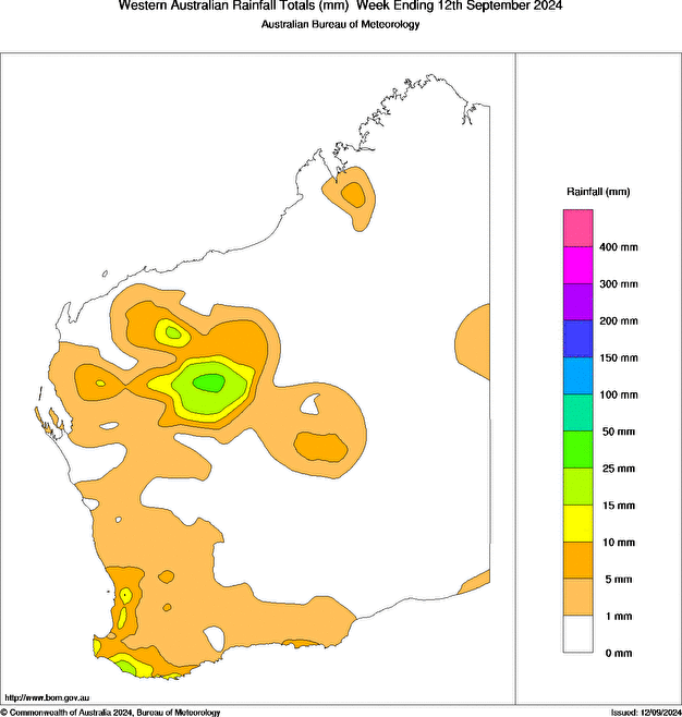
Image: Rain totals for the week ending on Thursday, September 12. Source: Bureau of Meteorology
The lightning was accompanied by this rainfall, which dampened the chance of fires being lit by the strikes in a time of high fire danger. The map below shows no hotspots or going fires in the Pilbara region on Thursday afternoon, September 12.
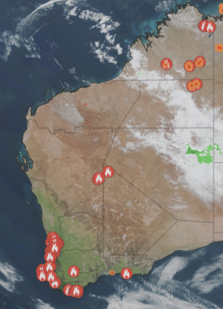
Images: Himawari-9 satellite image, hot spots and fires at 1:30pm on Thursday, September 12
The image above also shows an atmospheric gravity wave off the northwest coast of WA, which was caused by thunderstorms on Wednesday night.
This pattern will also bring extreme heat to WA's northwest for at least four to five days, elevating fire danger in the region.
Looking ahead, the storms have now eased in the region, however the Kimberley and the NT should see decent thunderstorm activity early next week.
Title image credit: @an.other.perspective/Instagram
- Other news
- Wed 18 Sep 2024 How Storm Boris became 'the perfect storm'
- Tue 17 Sep 2024 Darwin hasn't seen September rain like this for decades
- Tue 17 Sep 2024 Extreme fire danger predicted in Sydney this Thursday
- Tue 17 Sep 2024 Adelaide's coldest spring morning on record
- Mon 16 Sep 2024 Spring seesaw-warmth returning after a chilly start to the week