News
‹ back to weather news
News
-
Heavy rainfall and thunderstorms to persist in eastern Queensland
Yoska Hernandez, 15 December 2024A stubborn weather pattern is set to fuel persistent showers and thunderstorms in eastern Queensland, keeping the region wet and unsettled well into mid-next week. A surface trough near the coast is drawing in moisture-rich easterly to southeasterly winds, with an upper-level low providing a dynamic boost, supported by warmer-than-usual sea surface temperatures. Some of these storms could bring heavy rainfall, with totals expected to increase as the system develops.
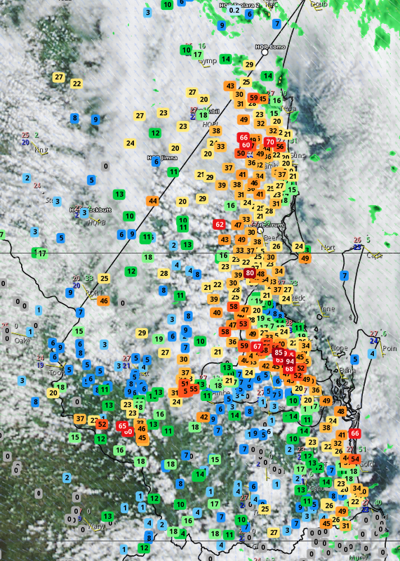
Multiple locations in southeast Queensland recorded significant precipitation to 9am this morning, with totals ranging from 20 to 95mm, including 70.2mm at Brisbane, mostly falling during yesterday afternoon.

Image. Accumulated rainfall in the Southeast Coast of up to 9am this morning.
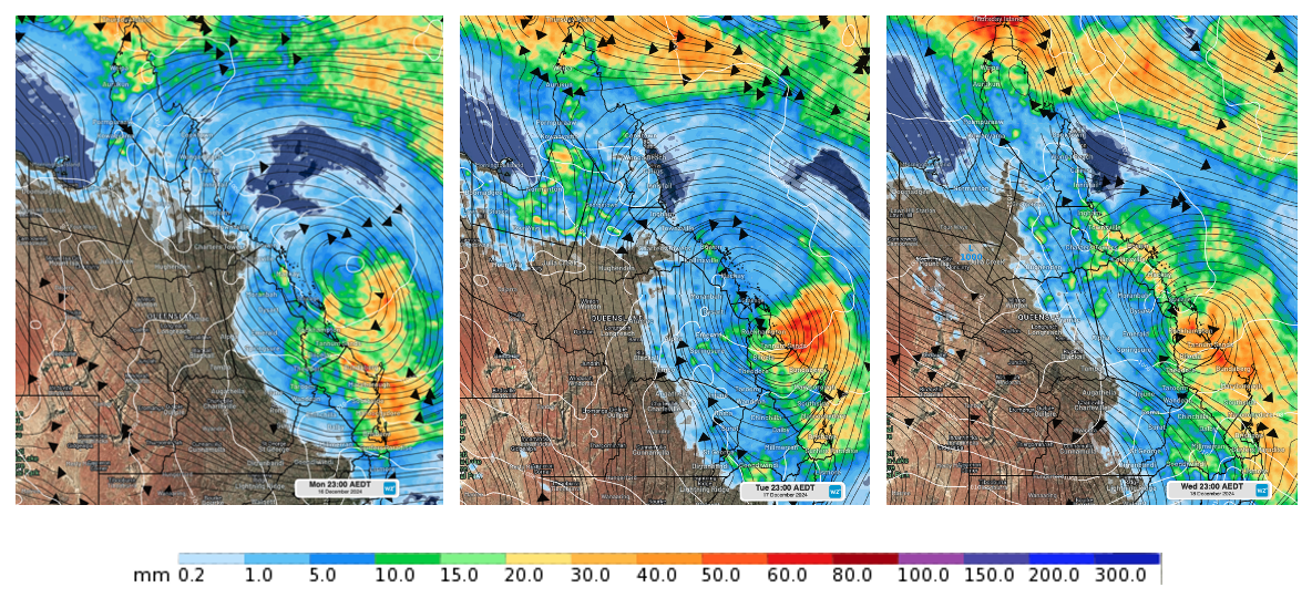
The images below illustrate the atmospheric pattern expected in the coming days, highlighting the surface trough (mean sea level pressure, MSLP), the daily rainfall field, and winds at an altitude of approximately 5.5km, represented by black streamlines.

Mean sea level pressure (white contours), daily precipitation field (colours), and winds at approximately 5.5km altitude (black streamlines) for Monday 16th, Tuesday 17th, and Wednesday 18th December. ECMWF model.
The dynamics behind the weather: a stirring analogy
To better understand the dynamics at play, think of a spoon stirring a glass of water from the top. As the spoon moves through the water, it creates a disturbance that sets the water in motion below. Similarly, the upper-level low acts like the spoon, stirring the atmosphere and enhancing the upward motion of air. This rising air fuels the intensification of the surface trough, causing the system to intensify. As the air ascends, it cools and condenses, forming clouds and increasing the potential for heavy rainfall. The surface trough, acting as a boundary, channels moisture-rich air from the ocean—boosted by the unusually warm sea surface temperatures—into the system.
The impact of warmer-than-normal sea surface temperatures
Warmer-than-normal sea surface temperatures in the Coral Sea play an important role in this setup. These above-average temperatures provide an abundant source of moisture, which is drawn into the system by the easterly to southeasterly winds. The increased moisture content enhances the instability of the atmosphere, creating the conditions necessary for thunderstorms to develop.
Forecast outlook
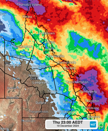
Broad regions of central, eastern, and southeastern Queensland are set to receive daily rainfall totals ranging from 20-60mm through to mid-next week. Some areas may accumulate more than 150-250mm by the end of the week, depending on the exact position of the system.
By late Wednesday and Thursday, a strong southerly change will move up the southeastern Queensland and central coast regions, gradually clearing significant precipitation from these areas while shifting the rainfall focus to the northern parts of the state.

Accumulated precipitation for the 4 days leading up to Thursday, December 19, according to ECMWF.
- Other news
- Fri 13 Dec 2024 Huge heatwave about to bake Australia
- Fri 13 Dec 2024 Canberra facing hottest day in almost five years
- Thu 12 Dec 2024 Victoria's first 45°C in four years on the horizon
- Thu 12 Dec 2024 'Everest of the Seas' races through Aussie waters
- Wed 11 Dec 2024 40°C on the horizon for Melbourne and Adelaide

