News
‹ back to weather news
News
-
Extreme heat to hit Australia as monsoon remains elusive
Ben Domensino, 7 January 2025A large mass of extremely hot air will linger over Australia for at least the next week, possibly causing temperatures to approach 49°C in some states and territories.
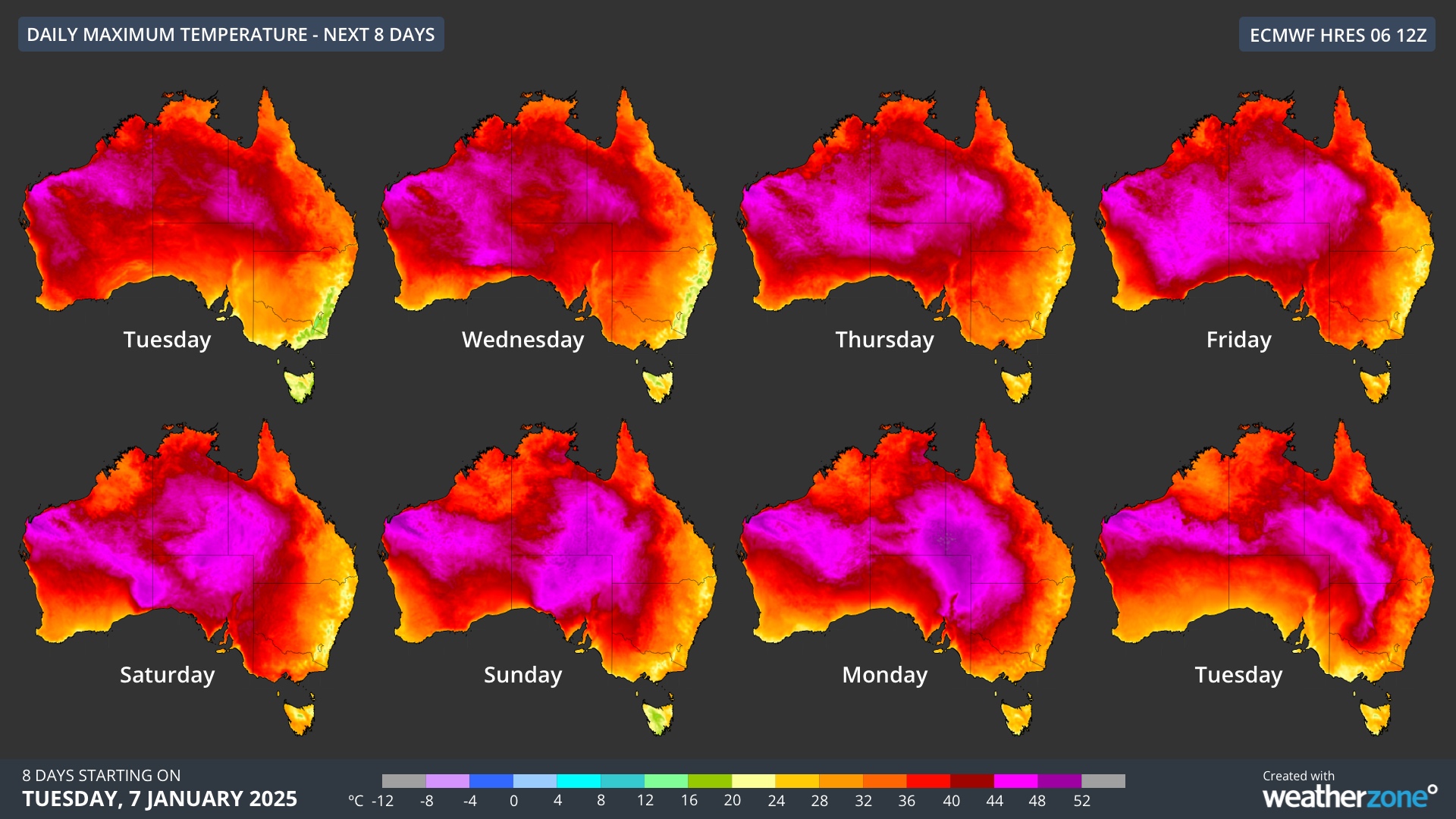
The maps below show the forecast maximum temperatures over Australia on each of the next eight days. The dark red and magenta colours represent temperatures over 40°C.

Image: Forecast daily maximum temperatures during the 8 days from January 7 to January 14, 2025, according to the ECMWF-HRES model.
The hottest air is currently being held over northwestern Australia by a large high pressure system centred near Tasmania. However, as this high moves into the Tasman Sea from Wednesday, the heat will be allowed to drift further south and east into the second half of the week.
With no active monsoon over northern Australia, this hot air mass will have no trouble building in intensity and causing temperatures to soar over a large portion of the country during the next week or so.
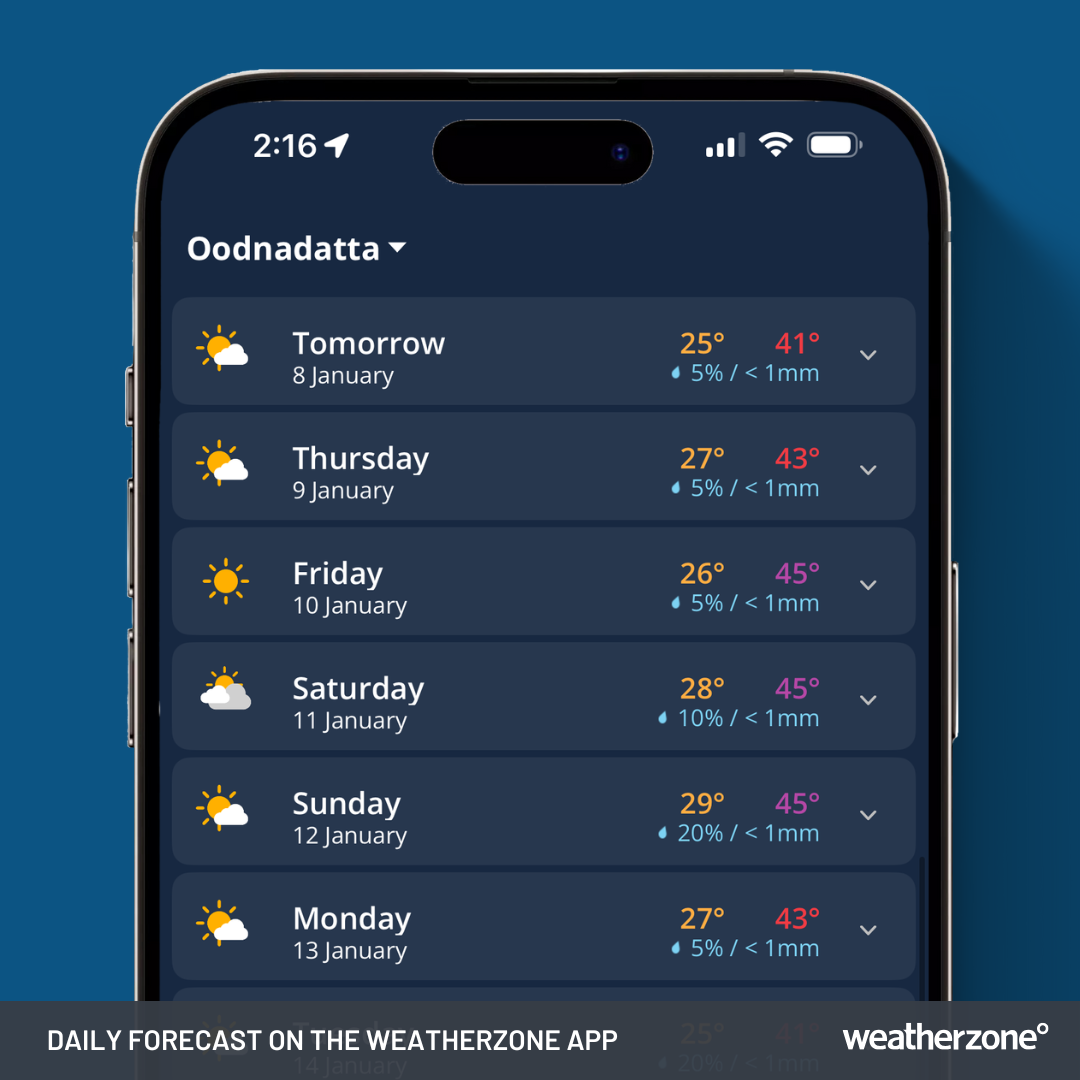
Forecast models suggest that temperatures could approach 45°C in parts of WA, SA, the NT and Qld from Friday. By Monday next week, some models predict the mercury could nudge 49°C in the Simpson Desert region.
Image: Daily forecasts for Oodnadatta, SA on the Weatherzone app. Forecasts valid on January 7, 2025.
While Australia’s interior is notorious for extreme heat in summer, temperatures nearing 49°C are rare in this area. The highest temperature on record in Qld is 49.5°C at Birdsville in 1972, while the NT’s record sits at 48.3°C from Finke in 1960.
One reason for the build-up of intense heat this week is the lack of monsoon cloud and rain over Australia’s tropics.
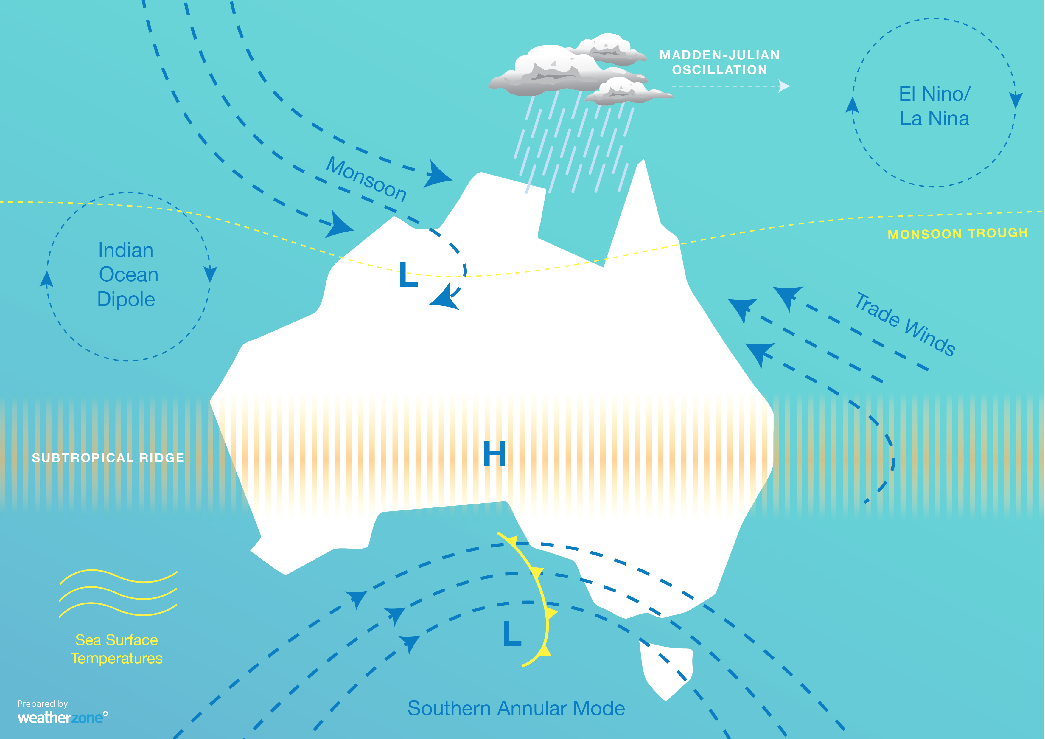
The monsoon refers to the seasonal reversal of winds over northern Australia, where the prevailing southeasterly winds switch to northwesterlies. The monsoon brings moisture-laden air from the Indonesia region towards Australia, increasing cloud cover and rainfall over the Australian tropics, which helps to reduce temperatures.

Image: Australia’s primary climate influences, showing the monsoon over northern Australia.
In an average year, the monsoon typically arrives in Darwin in late December, however it has failed to show up at all over northern Australia so far this season. As a result, Darwin just had its driest December in five years.
The absence of the monsoon over northern Australia so far this summer has been allowing repetitive bouts of hot air to slosh around the country. While this happens every year, it’s unusual for this tropical heat to persist uninterrupted so far into the season.
- Other news
- Wed 08 Jan 2025 Big week of global weather kicks off 2025
- Tue 07 Jan 2025 Stormy weather setting in for eastern, northern Australia
- Mon 06 Jan 2025 Finally, some relief for emergency services in SA, Vic
- Mon 06 Jan 2025 Record-warm oceans surrounded Australia in 2024
- Sun 05 Jan 2025 Earth has passed its closest point to the sun


