News
‹ back to weather news
News
-
Almost 2 million lightning strikes in wild eastern Australian storms
Anthony Sharwood, 16 January 2025An intense line of storms lashed eastern New South Wales and Victoria on Wednesday afternoon and evening, cutting power to thousands, causing flash flooding, and tragically killing one man in the NSW Central West town of Cowra when a tree fell on his vehicle.
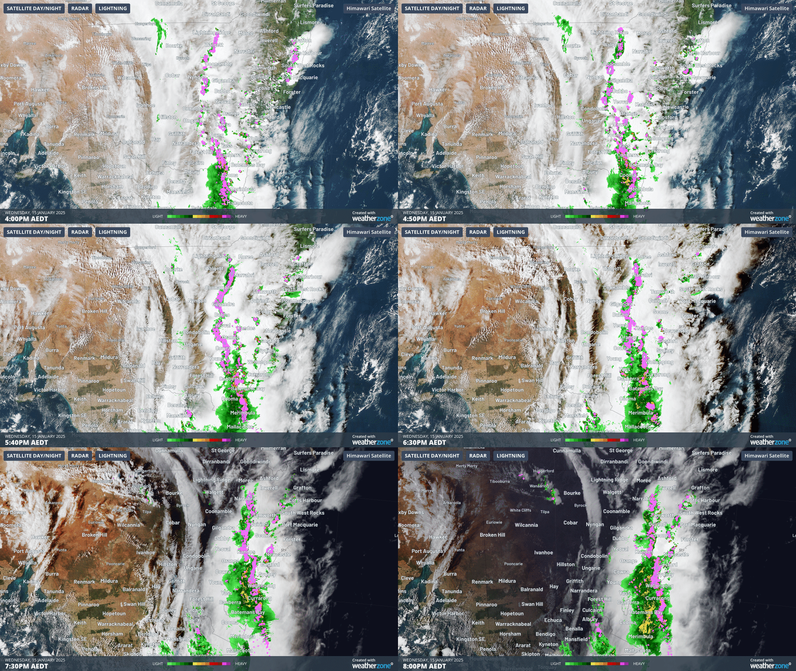
A well-defined squall line stretching from the north of NSW all the way down to the SE tip of mainland Australia started to form early in the afternoon.
The line of storms marched across the southeast as evening approached, before roaring into Sydney as darkness settled upon the city.

Image: Four-hour radar loop showing the line of storms crossing southeastern Australia on the evening of January 15, 2025.
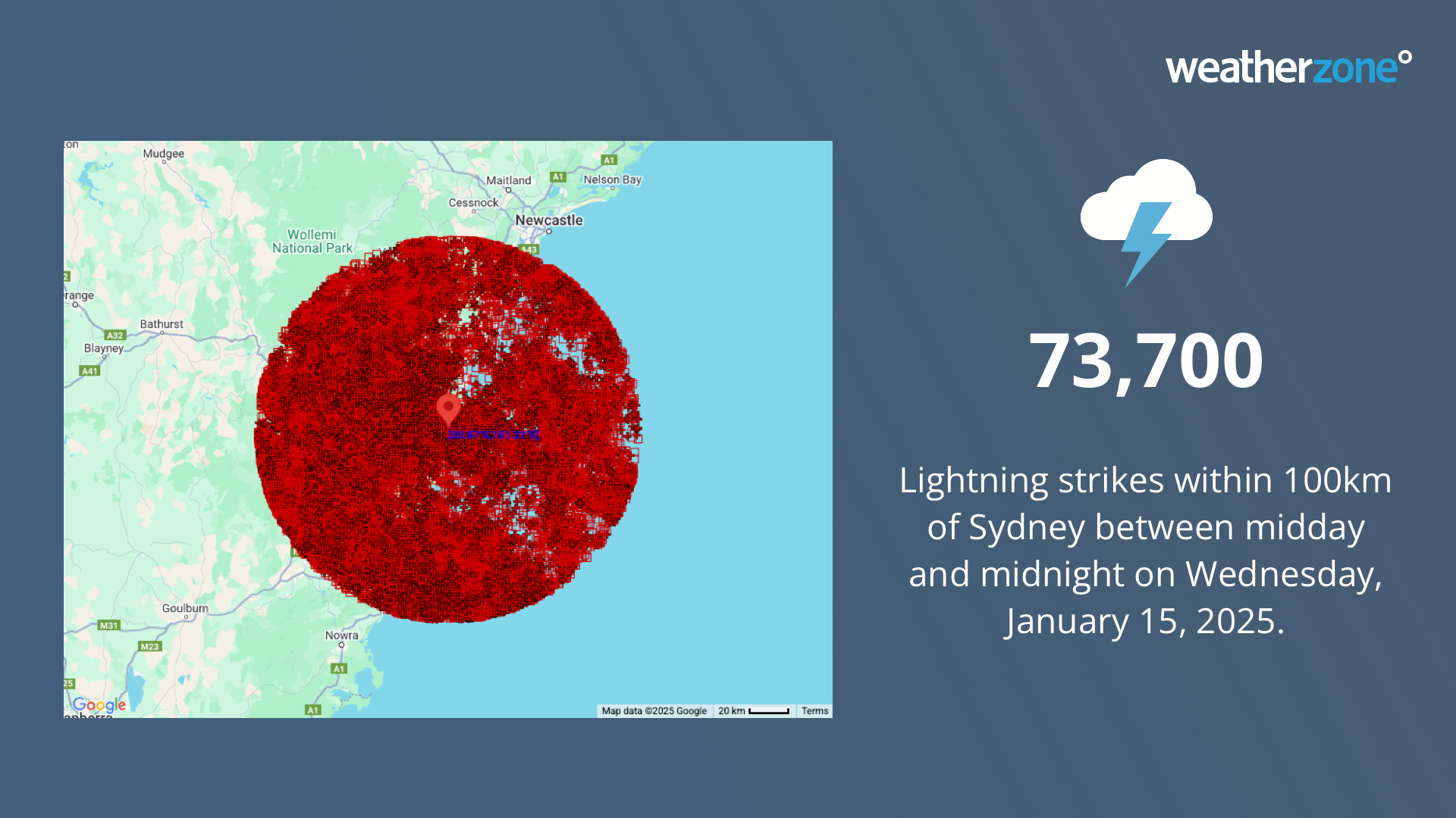
However Sydney skies were soon ablaze with lightning, with 73,700 strikes detected within 100km of the CBD and 8,777 strikes reaching the ground within 40km of Bankstown – hence the power outages.

Image: Location of lightning strikes within a 100km radius of the Sydney CBD in the 12 hours between midday and midnight on Wednesday, January 15, 2025.
In the 24 hours to 8am Thursday, a total of 1.819 million lightning strikes were detected by Weatherzone's Total Lightning Network in a broad arc from Queensland to Tasmania.
Well that’s one way to power up the lights at @SydShowground @sydolympicpark !
— E (@e13531) January 15, 2025
Lightning struck a light tower and the lights came on! #SydneyStorm #Sydney #Storm pic.twitter.com/TF1Bnj7hC0As you'd expect, strong wind gusts and intense rainfall were also features of this system. Here are some of the most notable observations from a remarkable day of storm activity:
Wind
- A gust of 120 km/h at Trangie, a small town about 500km northwest of Sydney
- A 120 km/h gust at Williamtown, just north of Newcastle, the strongest gust at that site in at least 23 years
- A 117 km/h gust at Kurnell in Sydney's south at 8:34pm. (It’s also worth noting that a gust of 95 km/h was recorded a little further south at Watamolla in the Royal National Park just after 6am on Thursday, in a different band of storms that developed under cooler southerly winds.)
- A 113 km/h gust at Cabramurra on the western flank of the Snowy Mountains, while a gust of 102 km/h was recorded at Bombala, in the far southeast corner of the Snowy Mountains forecast district. Interestingly, the region’s highest weather stations like Thredbo Top Station – which almost always cop the strongest winds in winter – did not record the region’s strongest gusts from this system.
- A 113 km/h gust at Murrurundi Gap, in the Hunter district at 8:06pm
- A 111 km/h gust at Merriwa, also in the Hunter district, at 7:30pm
- A gust of 107 km/h at Cowra Airport
- A gust of 106 km/h at Wagga Wagga, which was that city's strongest wind reading in 16 years
- A 100 km/h gust at Sydney Airport
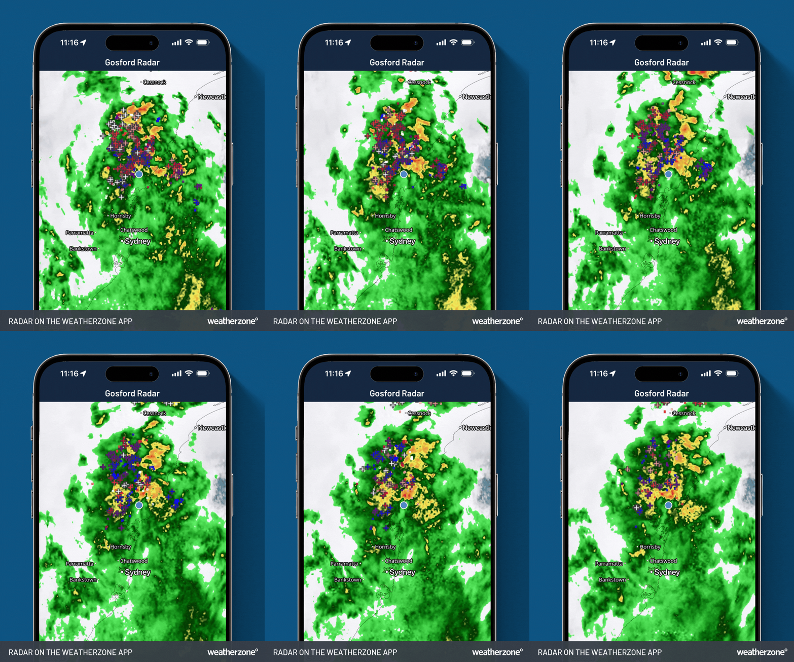
Image: Radar on the Weatherzone app for Gosford, NSW, showing the second band of storms on the morning of Thursday, January 16. The loop above shows our Pro Lightning Strike feature, with crosses indicating individual strikes.
Rain and hail
As this was a relatively quick-moving system, falls in most areas were significant without being record-setting.
- Only two locations recorded 24-hour rainfall totals exceeding 100mm – both of them on the NSW South Coast just south of Moruya, with a highest total of 127mm at Eurobodalla.
- Numerous locations received a midsummer top-up of 50mm or more.
However numerous heavy rainfall totals were recorded within a short time frame, including:
- 32mm at Perisher Valley within an hour (this was during a second band of storms around 10pm and it followed the mid-afternoon burst of 27mm inside 30 minutes)
- 31mm within 30 minutes at Argalong, just east of the Snowy Mountains
- 31mm within 30 minutes at Araluen, the peach-growing town just inland from the NSW South Coast
- 30mm within 30 minutes at Mandurama in the NSW Central West
Meanwhile, hailstones of up to 4cm in diameter were observed near the Central West town of Wellington around 6pm, however there were no reports of hail damage there or elsewhere.
Lightning over eastern NSW/ACT during the 24 hours to 9am on Thursday. pic.twitter.com/J5njPkFte6
— Andrew Miskelly (@andrewmiskelly) January 15, 2025The weather has now taken a turn this Thursday morning across most of the areas mentioned, with winds shifting to cooler southerlies across Victoria and much of NSW.
However the southerly change has not yet reached the NE corner of NSW, with temps already edging towards the 30s just inland of Byron Bay just before 10am at the same time as it was a chilly four degrees at Thredbo in the state's south.
That means that severe thunderstorms are still possible in northeastern NSW and southeast Queensland on Thursday.
For the rest of storm-lashed NSW, a cooler day is in store with damp conditions prevailing on some parts of the coast and some storms still possible even in areas where the cool change has arrived.
- Other news
- Thu 16 Jan 2025 Another big cold burst for U.S. following strong cold front this weekend
- Wed 15 Jan 2025 Severe thunderstorm outbreak hitting eastern Australia
- Wed 15 Jan 2025 Atmospheric chain reaction over Queensland
- Tue 14 Jan 2025 Australia's tropical cyclone risk increasing next week
- Mon 13 Jan 2025 Another Santa Ana wind burst to hit LA firegrounds


