News
‹ back to weather news
News
-
Saturday started with deluges over Sunshine Coast
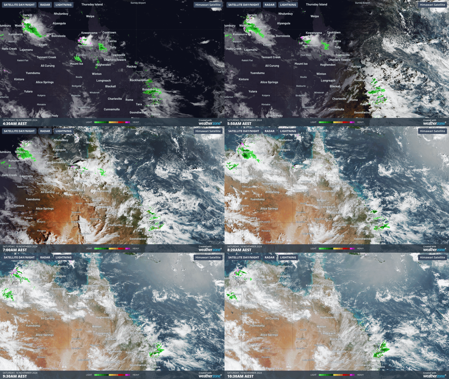
Aline Ribeiro, 16 November 2024A small but powerful area of instability developed over Queensland's southeast this morning, bringing heavy rainfall and thunderstorms to the region.

Image: Satellite imagery showing the severe thunderstorm developing over Queensland.
Landsborough, about 75km north of Brisbane, received an impressive 92mm of rainfall in the three hours to 9am, with 57mm falling in just one hour! During the same period, Bald Knob saw 62mm in three hours, and Diamond Valley got 25mm in three hours. In addition to the heavy rain, there have been more than 38,000 lightning strikes in the southeast of the state since midnight. Ben Domensino wrote a great story about the chance of million strikes in Australia this weekend.
A low pressure trough will cross the state, generating areas of deep clouds and thunderstorms from far northwest to southeast from today until early next week.

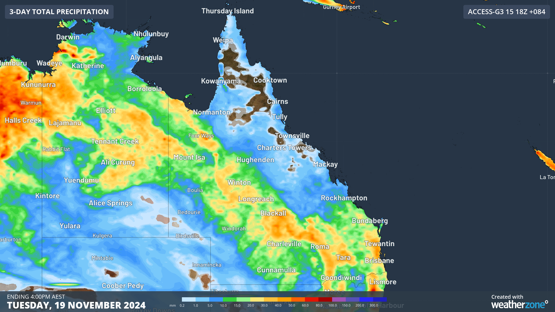
Image: Accumulated precipitation for the 3 days leading up to Tuesday, November 19, according to Access-G
Accumulation precipitation could reach 60 to 80mm in thunderstorm activity over the next 3 days, with a risk of flash flooding, mainly over Southeast Coast and Wide Bay and Burnett. Also, Central West and Maranoa and Warrego will see showers and thunderstorms in the next few days.
So, stay tuned and check the forecast and warnings for your region here.
- Other news
- Mon 25 Nov 2024 Severe heatwave takes hold of NSW
- Mon 25 Nov 2024 Heaviest rain in almost three years in Victorian city
- Mon 25 Nov 2024 Big stormy end to spring looms for Australia
- Sun 24 Nov 2024 Nature’s air conditioner: how the seabreeze will help Sydney cope during the heatwave
- Sat 23 Nov 2024 Ever Wondered Why It Takes Longer to Fly from Brisbane to Perth Than the Other Way? Here’s the Surprising Reason!

