News
‹ back to weather news
News
-
Queensland city beats December rainfall record before Christmas
Quincy Tut, 22 December 2024A hefty dump of rain through the sunshine state's Herbert and Lower Burdekin district pushed gauges towards their limits on Saturday.
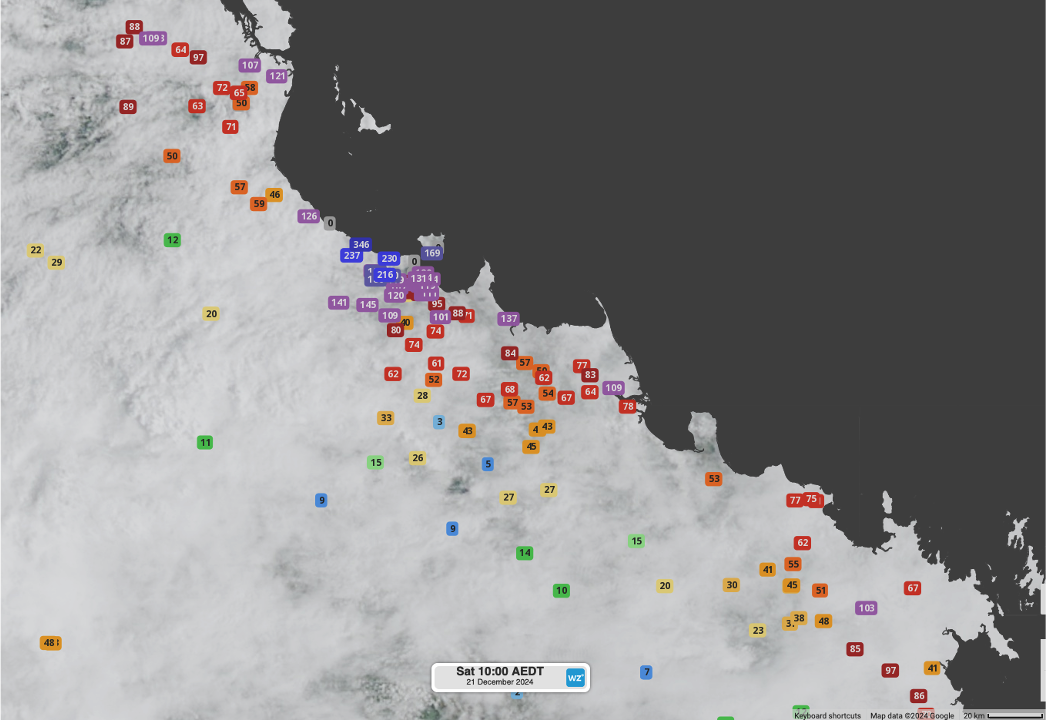
North Queensland's largest urban centre, Townsville, registered one for the history books, with a whopping 127.2mm recorded in the 24 hours to 9am on Saturday. A couple points put this into perspective, in nearly one hundred years of records:
- This one-day period of rainfall exceeds the entire month of December's average rainfall (123.5mm).
- The falls pushed the city's monthly total beyond its previous record from 1975 (458.0mm), with ten days still to go in December.
- Over half of the monthly rainfall has occurred in the 48-hour period from 9am Thursday to 9am Saturday (238.5mm).

Image: 24-hour rainfall totals to 9am AEST on Saturday, 21st December, encompassing the Herbert and Lower Burdekin and northern parts of the Central Coast and Whitsundays, using Himawari satellite imagery.
Rain has fallen on fifteen of the twenty-one full days of December in 2024 in Townsville. This means it is on track to have the highest number of rain days for December since 2010, if just two more days of rain occur for the rest of the month.
Townsville's rainfall didn't even come close to some sites further to the northwest. The most significant of these in the 24 hours to 9am Saturday included:
- 341mm at Toolakea
- 237mm at Bluewater
- 227mm at Bushland Beach
- 216mm at Stony Creek
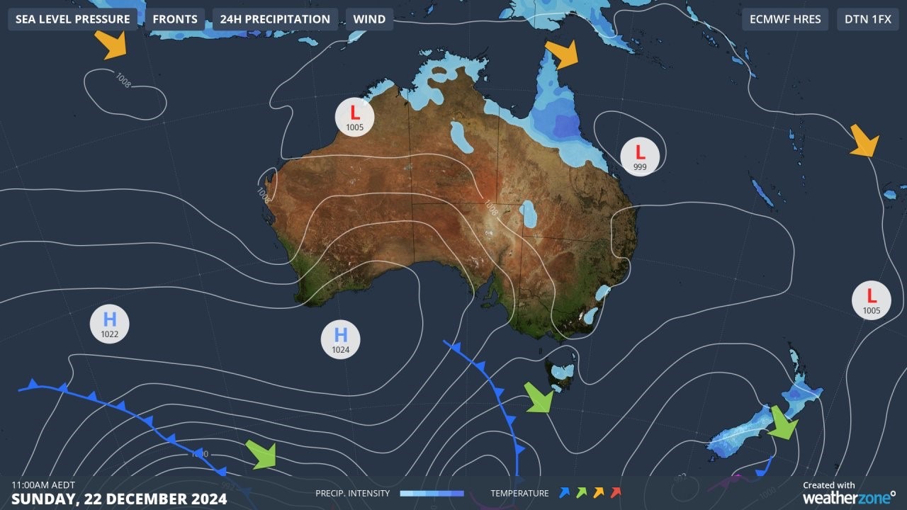
A large contributor to this enhanced rainfall was a tropical low along the coast, which saw the heaviest of falls for the month so far in coastal Northern and Far North Queensland on Thursday and Friday.

Image: The tropical low is moving east over the Coral Sea. High precipitation intensity has been observed in the 24 hours to Sunday morning over Northern Queensland (Weatherzone).
Rainfall is expected to ease in northern Queensland in the coming days as the low moves east, though a bout of heat is expected in its wake as another surface trough lingers over the state's interior. Low-intensity heatwave conditions will develop from today across the east.
Keep an eye on our latest warnings and forecasts on our website.
- Other news
- Sat 21 Dec 2024 Victoria bushfire forcing evacuations, smoke spilling into NSW
- Fri 20 Dec 2024 Relentless rainfall soaking northeast Queensland, more to come
- Fri 20 Dec 2024 Extreme heatwave hits WA, could set Perth's warmest December night on record
- Thu 19 Dec 2024 Severe rainfall deficiency behind Grampians bushfire
- Thu 19 Dec 2024 Hot Christmas Day on the horizon for Australia

