News
‹ back to weather news
News
-
Cold outbreak brewing with possible summer snow
Anthony Sharwood, 10 February 2025With tropical cyclones currently active in Australian waters and repeated heatwaves in recent weeks, the weather gods have decided to throw a little Aussie summer snow into the weather mix.
Towards the end of the working week and into the weekend, a cold front will sweep northwards over Tasmania, with unseasonably cold air reaching as far north as southern NSW and the ACT.
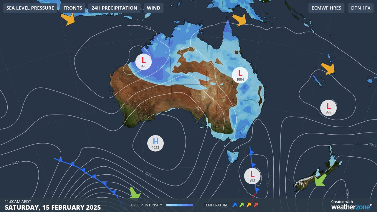
Image: Cold air in a southerly stream will push onto the southeastern mainland on Saturday after the passage of the cod front through Tasmania.
For Tasmania, snow is likely in the highest parts of the state, while flakes could also fall at the highest elevations of Victorian and NSW ski resorts like Mt Hotham and Thredbo.
This weather system is extremely timely for Tasmanians who are currently battling serious bushfires. A statewide soaking will accompany the cooler weather, with widespread showers continuing through to Sunday.
The fires have already burnt out 30,000 hectares and have forced the closure of the iconic Overland Track to walkers.
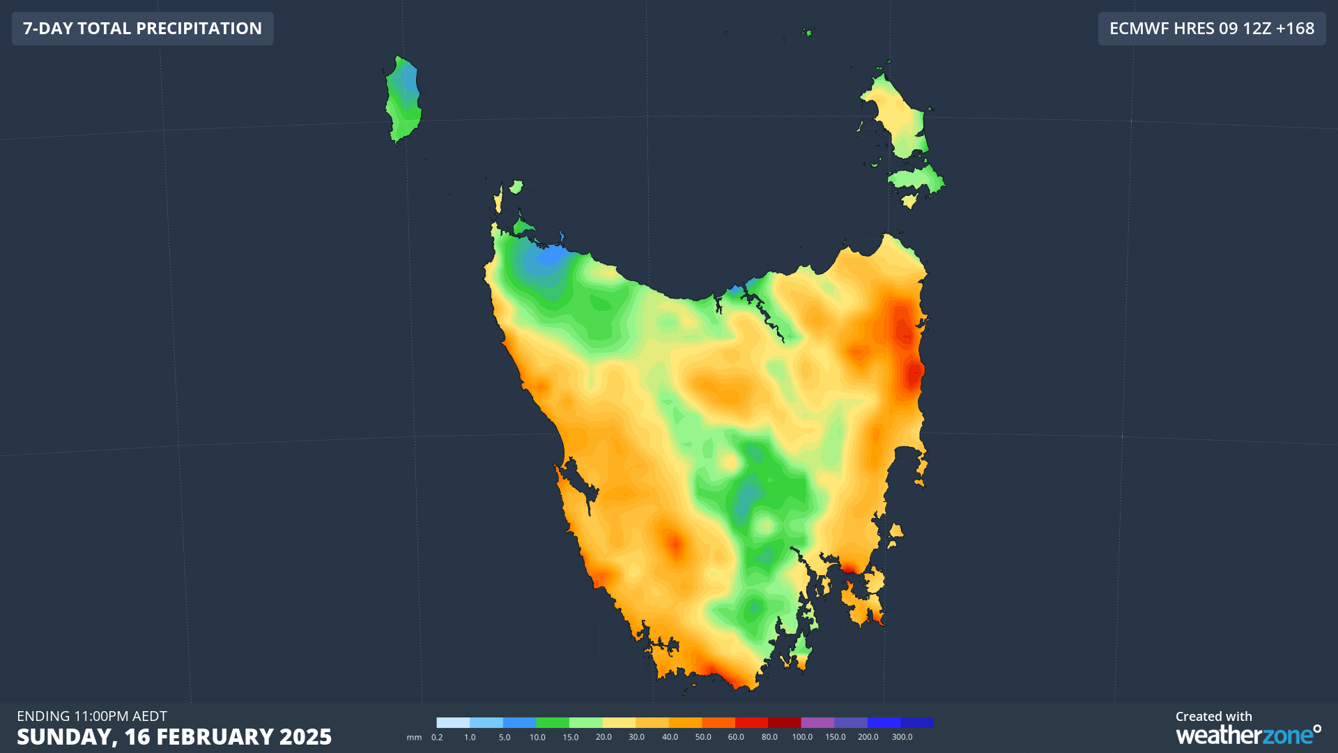
Image: Every single corner of the state should get a decent drop by the end of the weekend, with falls on the west coast heavy enough to enable firefighters to gain a significant foothold on the sate’s bushfires.
To illustrate just how dry Tasmania has been to date in 2025:
- Hobart has had less than 30mm.
- Launceston has not yet cracked 15mm in total.
- Even Queenstown, on the normally reliably soggy west coast, has had less than 20mm.
Meanwhile as the cool air flicks the southern mainland, Melbourne is heading for maximums of just 19°C and 18°C respectively on Saturday and Sunday – by far the coldest two-day spell of the 2024/25 summer to date.
Canberrans will feel a distinct overnight chill, with a pair of mornings reaching as low as 6°C on Sunday and Monday, while Perisher and Thredbo are expected to dip to a very chilly –3°C on Sunday morning.
- Other news
- Tue 11 Feb 2025 'Leave immediately': Tasmanians urged to flee fires
- Tue 11 Feb 2025 Severe tropical cyclone threat looms for WA
- Tue 11 Feb 2025 Southern Australia braces for hottest day in over 5 years
- Tue 11 Feb 2025 Queensland deluge continues but drier weather is on the way
- Mon 10 Feb 2025 Tropical cyclone to form near Australia this week