News
‹ back to weather news
News
-
Outback deluge to cause months of flooding
Ben Domensino, 24 March 2025An entire year’s worth of rain could fall over western Queensland this week, producing widespread flooding that could last for months and affect parts of four states and territories.
A slow-moving upper-level trough will interact with a stream of tropical moisture to cause persistent, heavy and widespread rain and thunderstorms over Australia’s eastern Interior this week.
One of the standout features of this weather pattern will be its slow movement, which will allow heavy rain to continue over a similar part of the country for several days.
The map below shows modelled upper-level winds and atmospheric moisture on Tuesday morning, revealing a bend in the sub-tropical jet stream that’s helping to drive tropical moisture over Qld.
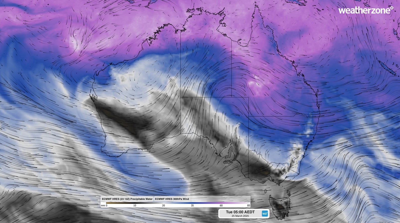
Image: Modelled 300 hPa wind and precipitable water at 5am AEDT on Tuesday, March 25, 2025.
This bend in the subtropical jet will provide ample fuel for rainfall over western Qld in the coming days.
Forecast models predict that around 100 to 300mm of rain will fall across a broad area of outback Qld this week, with isolated areas possibly seeing around 400mm. Heavy falls are also expected to impact parts of eastern Qld, NSW, SA, the NT and far northern Australia this week.
The map below shows the predicted accumulated rainfall this week from one computer model.
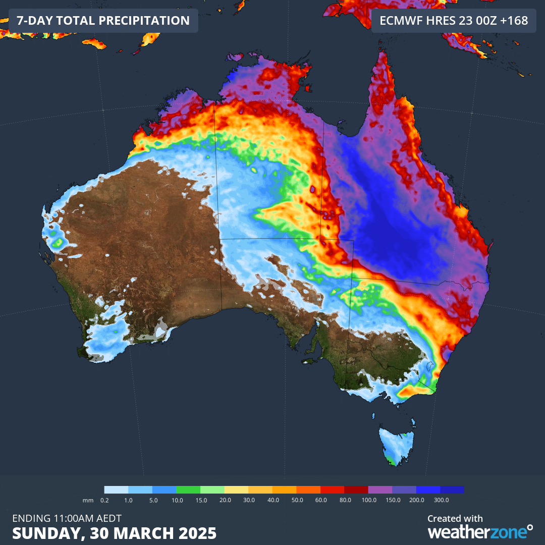
Image: Forecast accumulated rain this week, according to the ECMWF-HRES model.
Some places in western Qld could see 6 to 12 months’ worth of rain this week. Longreach’s annual average is about 430mm and some models are hinting at accumulated weekly totals of around 400mm in that region. The annual averages at Windorah (about 300mm) and Charleville (about 490 mm) are also in the range of what some models are anticipating this week.
It’s worth pointing out that computer models are struggling to agree on exactly where and how much rain will fall from this system. However, there is good model agreement that this week’s deluge will be intense enough to cause widespread flooding.
Flood watches have already been issued in parts of Qld, the NT and SA, and flooding is also expected to affect some rivers in northern NSW following this week’s rain.
Check the latest flood watches and warnings and severe weather warnings for the most up-to-date information on this ongoing event.
- Other news
- Tue 25 Mar 2025 Record-challenging wave periods detected off Sydney
- Tue 25 Mar 2025 Rare sight as the whole of Queensland covered in cloud
- Mon 24 Mar 2025 Perth facing hottest late-March spell on record
- Sun 23 Mar 2025 Intense rain and storms flooding Australia's interior
- Sat 22 Mar 2025 Dry outback town cruelly teased by nearby rain and storms