News
‹ back to weather news
News
-
ANZAC Day cold front all set
Jess Miskelly, 20 April 2025The typical ANZAC day cold front is due to hit Melbourne right on time. The yearly autumnal shift will come a few days earlier for Western Australia and NSW. Southern Qld—perhaps in deference to deluges last month—looks largely free of significant weather this Easter-to-ANZAC-Day week. Meanwhile, a tropical low over the Gulf of Carpentaria is keeping Darwin on its toes.
Southern Australia has been experiencing an unseasonably warm start to Autumn, with both Adelaide and Melbourne having their warmest April to date in over 130 years of records. Adelaide is averaging 27.0°C and Melbourne 24.4°C for the month so far—more than 4 degrees above the long-term averages. Canberra and Sydney have also been warmer than average.
But it's time. Change is brewing.
As predicted over a week ago, Easter Sunday and Monday are the beginning. A low pressure cell near southwest Vic has sent a puff of cool air over southeast SA that has led to Adelaidess coolest day of the year so far. The cooler air is just reaching Melbourne this afternoon and will impact Canberra and Sydney on Monday when the low takes a big northward turn to swing over NSW. This will end the eastern NSW sun and bring a shift to rainy conditions for at least the first half of the week.
Temperatures will recover over SA and Vic for one last hurrah later this week before the ANZAC front proper arrives. The cold front will hit WA first, bringing storms, rain and gusty winds on Wednesday, before reaching Adelaide, Melbourne and Hobart late Thursday or early Friday.
For those looking to attend dawn services in regional Tasmania, Victoria, southeast SA and southwest inland NSW, expect some gusty showers for company in most places.
Post-front, Saturday could be the coolest day of the year for Melbourne, potentially beating out the 17.7°C on April 4. After this front, temperatures should stay supressed over southeast Australia, especially southern Vic, for at least 3 to 4 days.
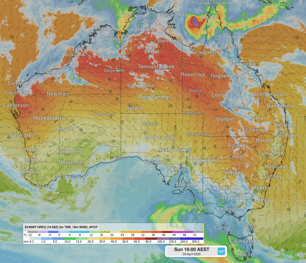
Image: Animation of daily afternoon temperature, wind and 24 hour rainfall showing warm air recovering over southern Australia before a cold front arrives mid to late week.
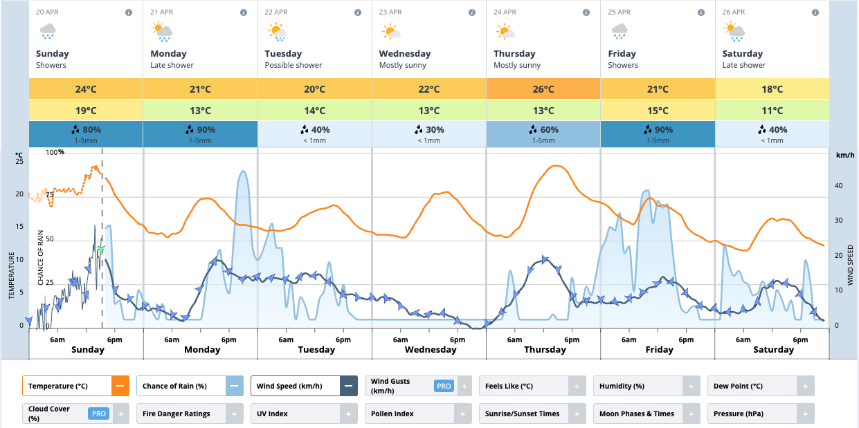
Image: Forecast graphic for Melbourne, showing an initial cool rainy shift Monday, the warm recovery Thursday then the cold shift on ANZAC Day and Saturday 26th.
- Other news
- Sun 20 Apr 2025 New data shows March 2025 was Earth's warmest on record
- Sat 19 Apr 2025 Ex-Tropical Cyclone Tam brings huge waves to NSW coast on Good Friday
- Fri 18 Apr 2025 Sydney Royal Easter Show forecast
- Thu 17 Apr 2025 Your Easter capital city weather forecasts
- Thu 17 Apr 2025 Severe Tropical Cyclone Errol to weaken before landfall