News
‹ back to weather news
News
-
The latest on La Niña
Ashleigh Madden, 21 February 2025A weak La Niña has been impacting northern Qld during the past few months, so what is in store for Australia as we head into autumn?
The US meteorological agency, NOAA, declared a La Niña event in mid-January, following a significant cooling of the central equatorial Pacific waters since late last year. In January 2024, waters around Australia hit their warmest levels on record, while contrasting ocean temperatures in the equatorial Pacific—warm near Australia and cooler in the central Pacific—indicate the influence of La Niña.
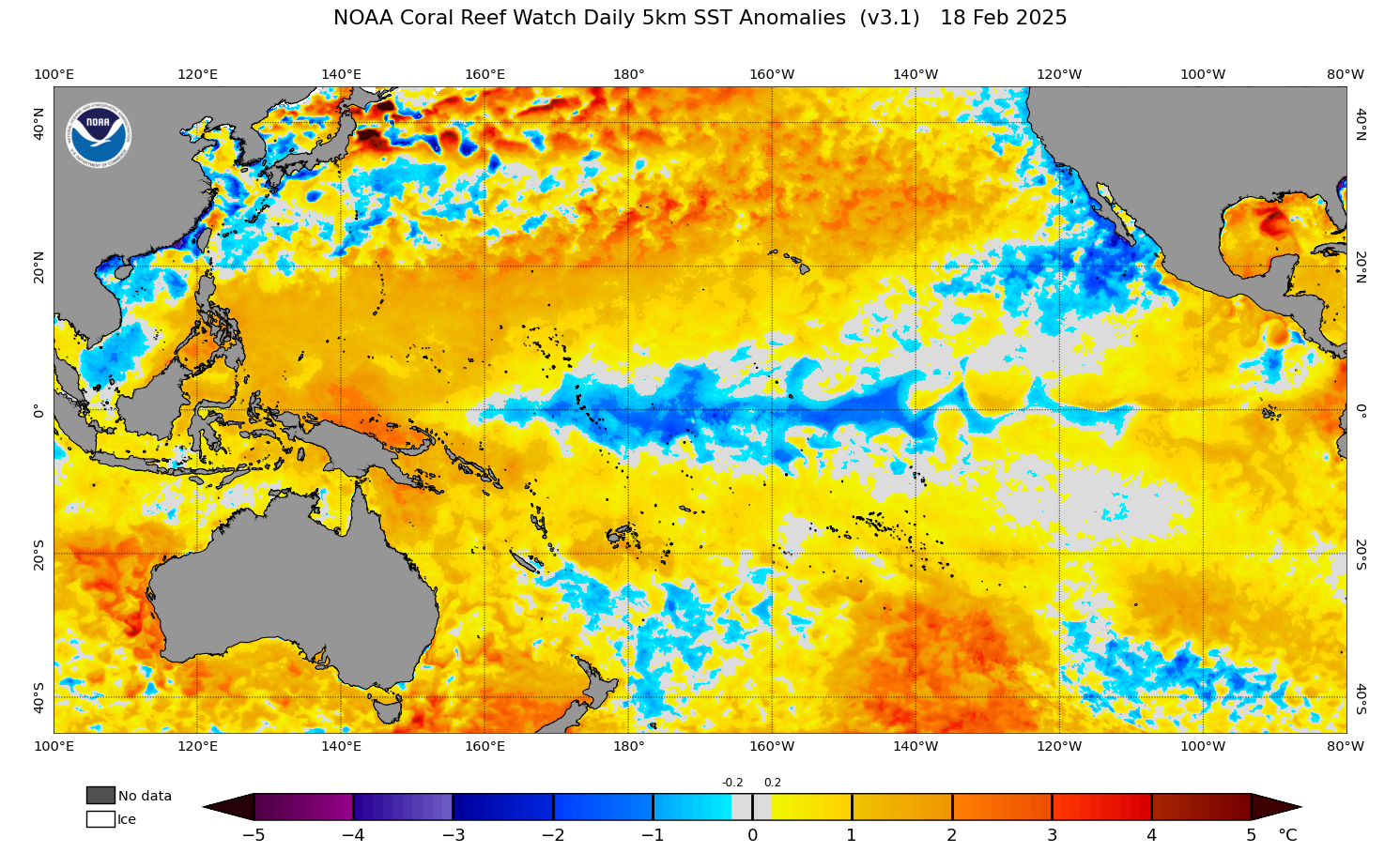
Image: Sea Surface Temperature anomalies on Tuesday, February 18, showing cool waters through the central equatorial Pacific and warm waters to the north of Australia. Source: NOAA Coral Reef Watch
While the cooling observed in the central equatorial Pacific has met the US La Niña criteria, it has not met the Bureau of Meteorology’s this year.
Despite difference in agencies opinions, La Niña has been impacting parts of northern Qld from December 2024, although has not extended its effect elsewhere in Australia.
The graphic below shows that parts of northern Qld have seen 200 to 400% of their average rainfall for the year to Thursday, February 20.
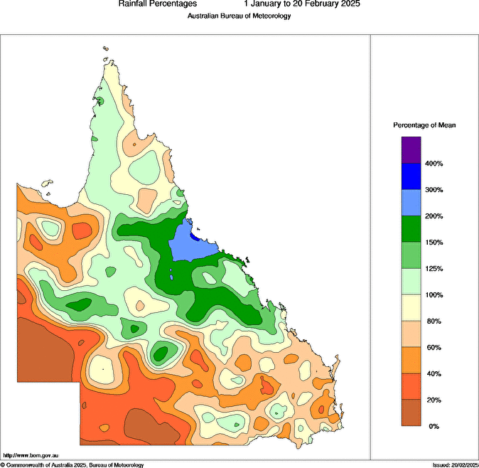
Image: Rainfall percentage of mean for January 1 to February 20, 2025. Source: Bureau of Meteorology
The well above average rainfall comes after the region was battered by 600 to 800mm of rainfall in the first 20 days of February, caused by the monsoon trough, multiple low-pressure systems, and the continued effects of La Niña.
Yet another bout of heavy rainfall is forecast for parts of northern Qld as a low-pressure system and trough is set to bring a wet end to February. This low-pressure system could develop into a tropical cyclone over the weekend, however the track into next week remains uncertain.
Parts of the NT and WA have also seen decent rainfall so far this year due to the last monsoon onset, a tropical cyclone, and multiple low-pressure systems.
Looking ahead, NOAA predicts that the weak La Niña should continue to impact parts of Qld until March or April, enhancing rainfall in the region.
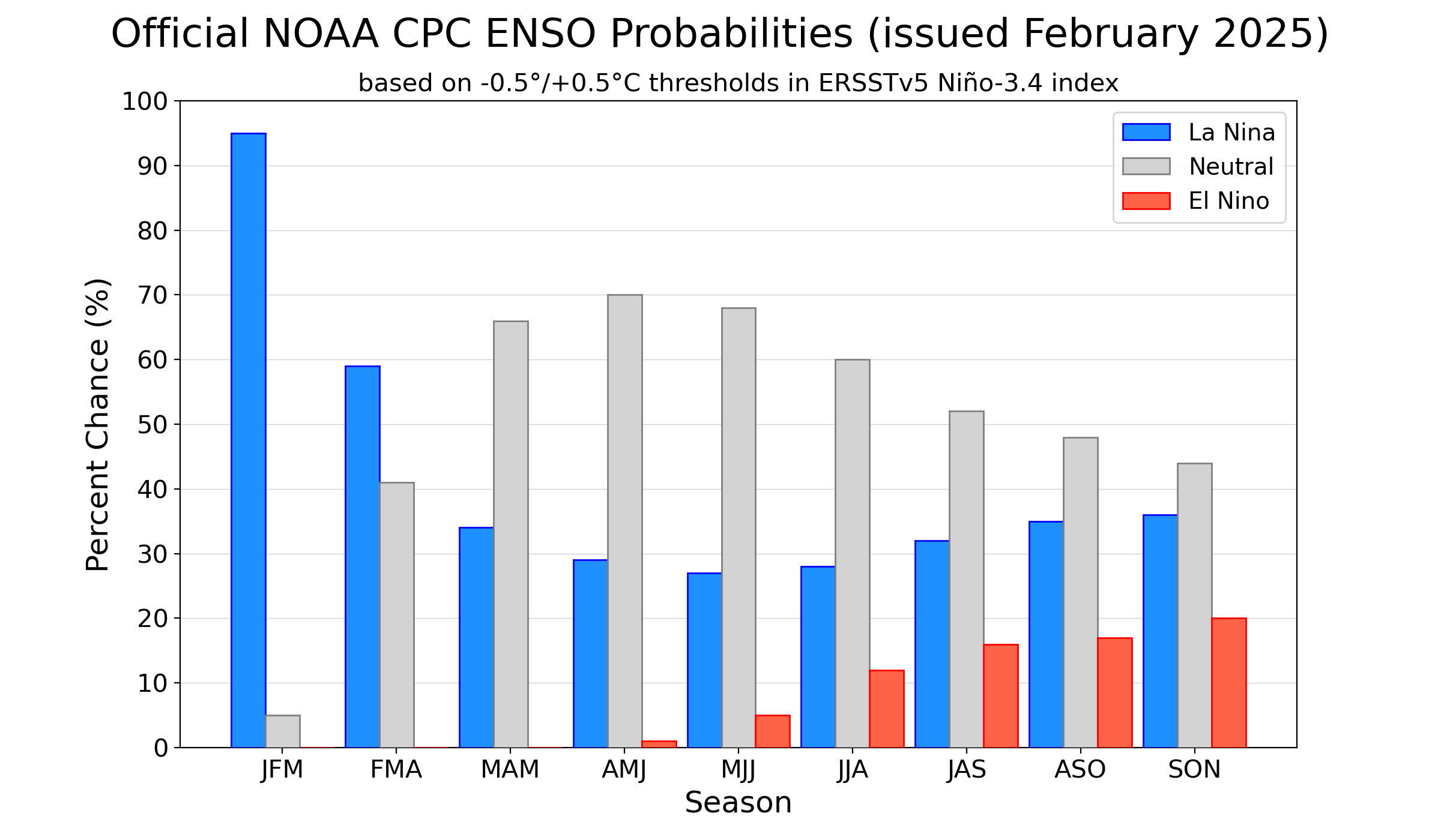
Image: El Niño Southern Oscillation (ENSO) probabilities issued in February, showing probability of La Niña (blue), neutral (grey) and El Nino (red) Source: NOAA CPC IRI
A neutral phase of the El Niño Southern Oscillation (ENSO) is forecast from autumn into winter, possibly spring, with no impact on Australia’s weather.
However, the warm oceans surrounding Australia should linger into winter at least, enhancing the moisture in the Australian region, particularly across the north, west and east of Australia.
The moisture will enhance rainfall across northern and eastern Australia during March and April. Another monsoon onset is forecast later in March, which will bring another bout of heavy rain, thunderstorms, and increased cyclone risk to northern Australia. Southern Australia’s rainfall in the coming months is forecast to be average to below average, depending on the number of cold fronts sweeping across the region.
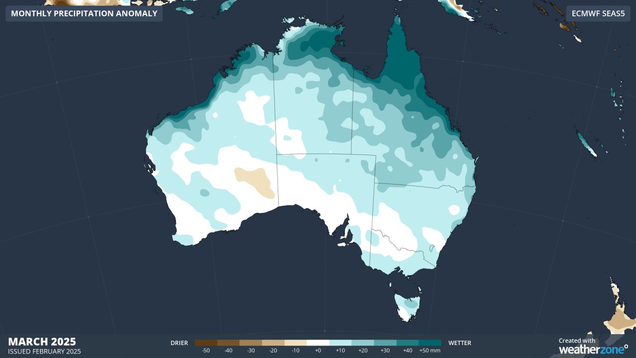
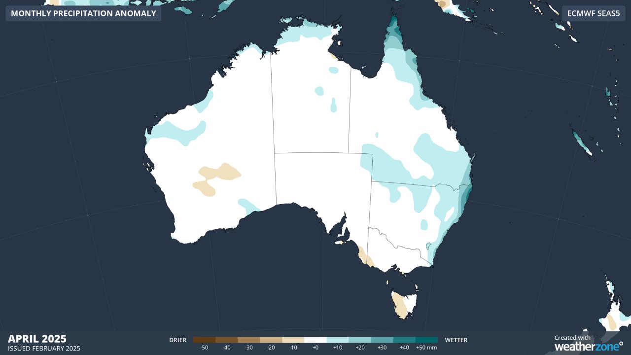
Image: Monthly precipitation anomalies for March (top) and April (bottom), according to the ECMWF model
Meanwhile temperatures should remain warm across much of Australia, with some cooler days across the north when heavy rain, thunderstorms, and thick cloud limit daytime heating.
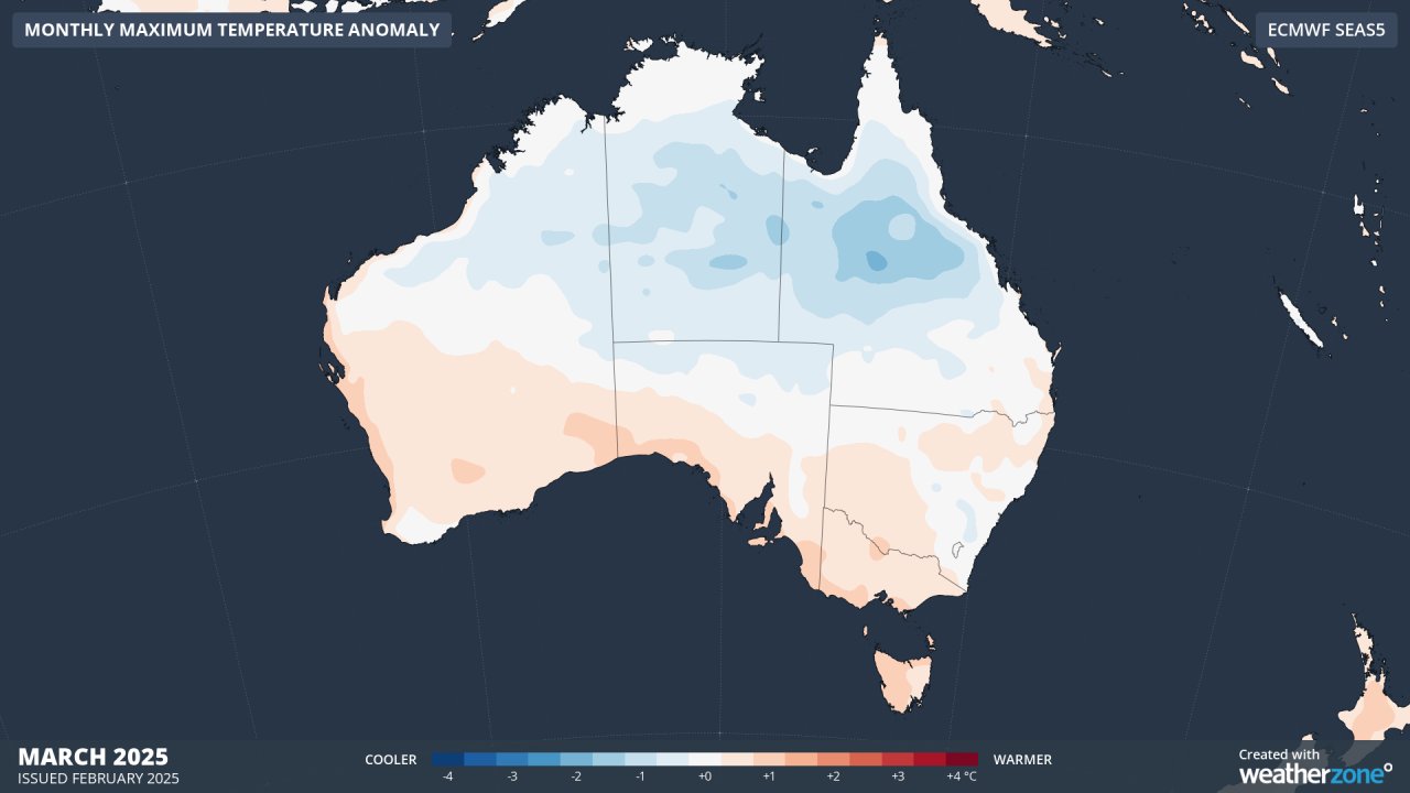
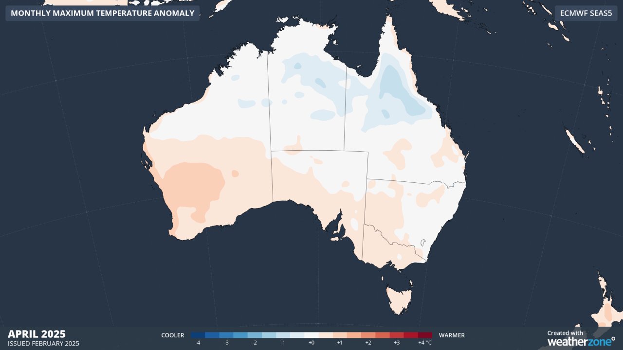
Images: Monthly maximum temperature anomalies for March (top) and April (bottom), according to ECWF.
While autumn days should be mostly warm, some drier air across southern Australia could bring cooler mornings and early season frost to the region.
- Other news
- Wed 16 Apr 2025 Adelaide sweats through record April hot spell
- Wed 16 Apr 2025 Tropical Cyclone Errol strengthening near Australia – here's what to expect
- Tue 15 Apr 2025 Adelaide's driest start to the year since the 1980s
- Tue 15 Apr 2025 Rare Sydney Harbour surf on Good Friday
- Mon 14 Apr 2025 Lyrid meteor shower – how to see it from Australia