News
‹ back to weather news
News
-
Heaviest rain in years soaks southern WA as storms slam Perth
Ben Domensino, 14 March 2025A cut off low pressure system has delivered the heaviest rain in more than a decade in parts of southwestern Australia and unleashed severe thunderstorms in Perth.
The animation below shows rain and thunderstorms hitting WA’s South West Land Division on Thursday. This outbreak of wet and stormy weather was caused by a low pressure system and associated low pressure trough interacting with a stream of tropical moisture.
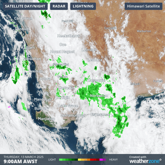
Image: Composite satellite, radar and lightning strikes showing rain and thunderstorms over WA on Thursday.
While the most widespread rain fell inland over the Wheatbelt, some of the most intense storms occurred in and around Perth.
During the 23 hours to 8 am AWST on Friday, widespread rainfall totals of 30 to 60mm had been recorded over a broad area stretching from Wongan Hills in the north to Laverton in the east and Albany in the south.
A few places picked up more than 80 mm in this period, including 106 mm at Bevan Street in Albany and 82 mm at Albany Airport, which was the airport’s wettest day in 13 years.
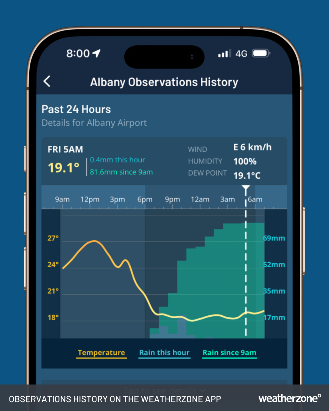
Image: Observations History on the Weatherzone app for Albany, WA.
While rainfall totals were lower in the 10 to 30 mm range for Perth, the city was battered by intense thunderstorms on Thursday.
More than 300,000 lightning strikes were detected within 400 km of Perth between Thursday morning and Friday morning. Some of these storms were severe, with wind gusts reaching 113 km/h at 2pm AWST in Gooseberry Hill in Perth’s east.
Rain and storms will continue to affect a broad area of WA on Friday before mostly contracting to the state’s north on the weekend.
- Other news
- Wed 16 Apr 2025 Adelaide sweats through record April hot spell
- Wed 16 Apr 2025 Tropical Cyclone Errol strengthening near Australia – here's what to expect
- Tue 15 Apr 2025 Adelaide's driest start to the year since the 1980s
- Tue 15 Apr 2025 Rare Sydney Harbour surf on Good Friday
- Mon 14 Apr 2025 Lyrid meteor shower – how to see it from Australia