News
‹ back to weather news
News
-
Nearly a million lightning strikes on wild NSW night
Anthony Sharwood, 22 April 2025Skies were ablaze over coastal New South Wales as the sun set on the Easter break, with a total of 878,269 lightning strikes detected within a 600km radius of Sydney.
The sky show was triggered by a combination of warm ocean temperatures and cold air in the upper atmosphere, as a cut-off low formed after a cold front crossed the coastline on Monday afternoon and evening.
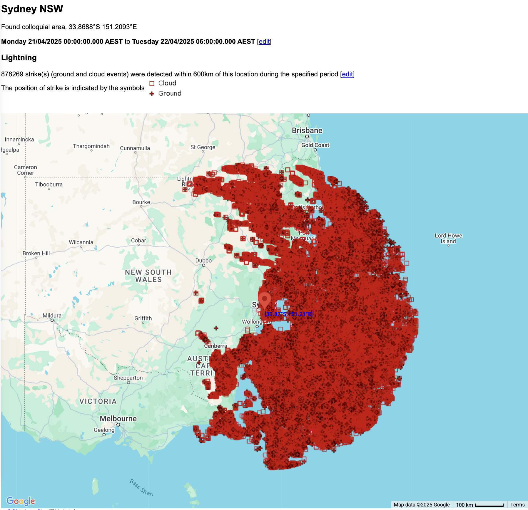
Image: Lightning strikes within 600km of Sydney from midnight Monday, April 21 to 6am Tuesday, April 22, 2025.
The combination of abundant cold air aloft and warm sea surface temperatures which are typical for mid-autumn provided the perfect ingredients for the spectacular lightning outbreak, especially just off the coast.
Image: Lightning over Sydney's eastern suburbs on the evening of Sunday, April 21, 2025.
Intense rain also fell in places, although it was very hit and miss, which is typical with this sort of set-up. The heaviest 24-hour totals to 9am Tuesday all occurred in the Shoalhaven region of the NSW South Coast. They included:
- Lake Conjola 101mm
- Ulladulla 80mm
- Currarong 80mm
Lighter falls also penetrated inland to parts of southern NSW and the ACT, with Canberra recording 7.8mm, after 3.4mm the previous day. While these two totals were unremarkable, they were very welcome after a 20-day rainless streak to start April in the nation’s capital.
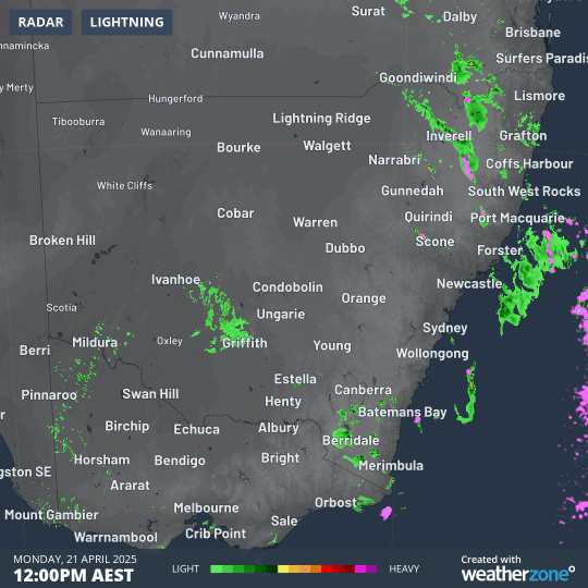
Image: 12-hour NSW radar loop from midday to midnight on April 21, showing the heavy rain and storms developing on the NSW South Coast during the afternoon and evening.
A period of unstable, showery weather lies ahead this week for much of the NSW coastline as moisture is pushed onshore in an easterly flow – with those warm sea surface temperatures enhancing the rainfall potential.
While Sydney is unlikely to experience one of its big autumn deluges, showers are a strong possibility every day this week.
Canberra will be drier in general, although it should see a few showers, especially on Anzac Day (Friday) and Saturday as a cold front approaches from the west.
- Other news
- Mon 21 Apr 2025 Easter bunny spotted in Australia's weather forecasts
- Sun 20 Apr 2025 ANZAC Day cold front all set
- Sun 20 Apr 2025 New data shows March 2025 was Earth's warmest on record
- Sat 19 Apr 2025 Ex-Tropical Cyclone Tam brings huge waves to NSW coast on Good Friday
- Fri 18 Apr 2025 Sydney Royal Easter Show forecast