News
‹ back to weather news
News
-
Wet week ahead for eastern NSW
Ben Domensino, 28 April 2025Rain will continue to soak parts of eastern NSW this week, with another 100 mm set to fall along already sodden stretches of the state’s coastline.
Satellite images captured on Monday morning revealed that cloud and rain were still lingering over eastern NSW following a weekend of torrential downpours.
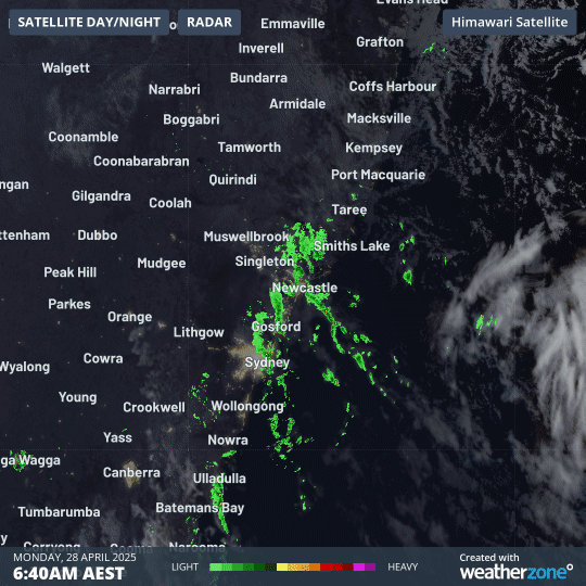
Image: Composite radar/satellite images showing cloud and showers streaming over eastern NSW on Monday morning.
During the 24 hours ending at 9am on Monday, parts of the Hunter Valley and Central Coast regions received 100 to 150 mm of rain, with a few slightly higher totals This included 154 mm at Mandalong, near Morisset, 142 mm at Crawford and 133 mm at Mount Barrington.
The low pressure system that caused the weekend’s heavy rain has now moved offshore, which will allow rain to continue easing through Monday afternoon into Tuesday morning. However, this respite could be short-lived, with another rain-bearing low pressure trough expected to develop near the NSW coast during the middle of this week.
Showers and areas of rain will affect parts of eastern and southern NSW on Tuesday before increasing again from Wednesday as the coastal trough deepens. This will lead to a wet few days from Wednesday into the weekend, during which time the rain will gradually spread further up the NSW coast and into southeast Qld.
The map below shows how much rain is predicted to fall over eastern NSW and southeast Qld this week. Some areas along the coast could see more than 100mm falling in the space of two days.
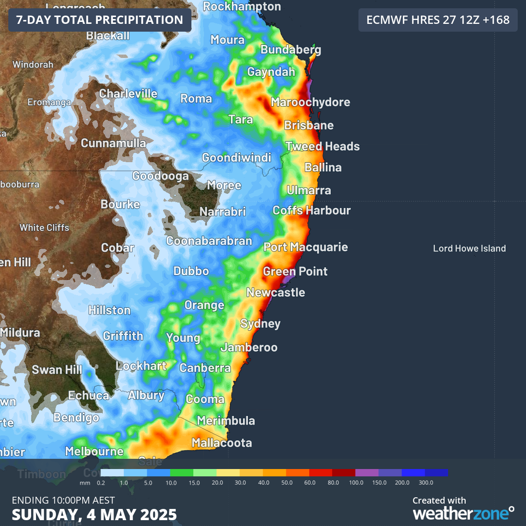
Image: Forecast accumulated rain this week, according to the ECMWF-HRES model.
This week’s rain generally won’t be enough to cause widespread flooding, although localised areas of flash flooding are possible, particularly along the coastal fringes.
In addition to the rain, a surge of blustery southerly winds and large waves will move up the NSW coast on Wednesday and Thursday then into southeast Qld on Friday.
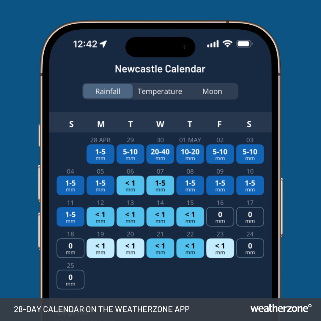
Image: 28-Day Rainfall Calendar on the Weatherzone app for Newcastle, NSW.
Severe weather warnings may be issued for rain, wind and waves throughout the week, so be sure to check the latest warnings in your area for the most up-to-date information in this weather system.
- Other news
- Mon 28 Apr 2025 Mesoscale low drenches NSW Hunter, Central Coast regions
- Sun 27 Apr 2025 NSW coast hit by heavy rain
- Sat 26 Apr 2025 Severe Weather in SE Australia
- Fri 25 Apr 2025 How weather impacted the original Anzac Day
- Thu 24 Apr 2025 How cold can Canberra get on Anzac Day?