News
‹ back to weather news
News
-
An electrifying start to October long weekend
Corine Brown, 5 October 2024More than 420,000 lightning strikes affected the nation’s east on Friday as a highly unstable trough and a cold front brought thunderstorms, some severe, to northeastern SA, NSW, Vic and southern QLD ahead of the October long weekend.
Thunderstorms began hopping the border from northeastern SA into NSW from 9am on Friday, October 4. By around 3pm, a clear line of storms had begun to develop in western NSW and was tracking slowly east, prompting the BOM to issue a severe thunderstorm warning for damaging winds. And sure enough, damaging winds eventuated, with a 91km/h wind gust recorded at Cobar airport at 4:30pm. By 6:15pm storms were bringing wind gusts of 76km/h to Bourke airport.
Meanwhile, down in Victoria, a small but severe thunderstorm delivered 5mm of rain in the 10 minutes to 4:30pm at Geelong, delivering the same amount to Rhyll just before 6pm.
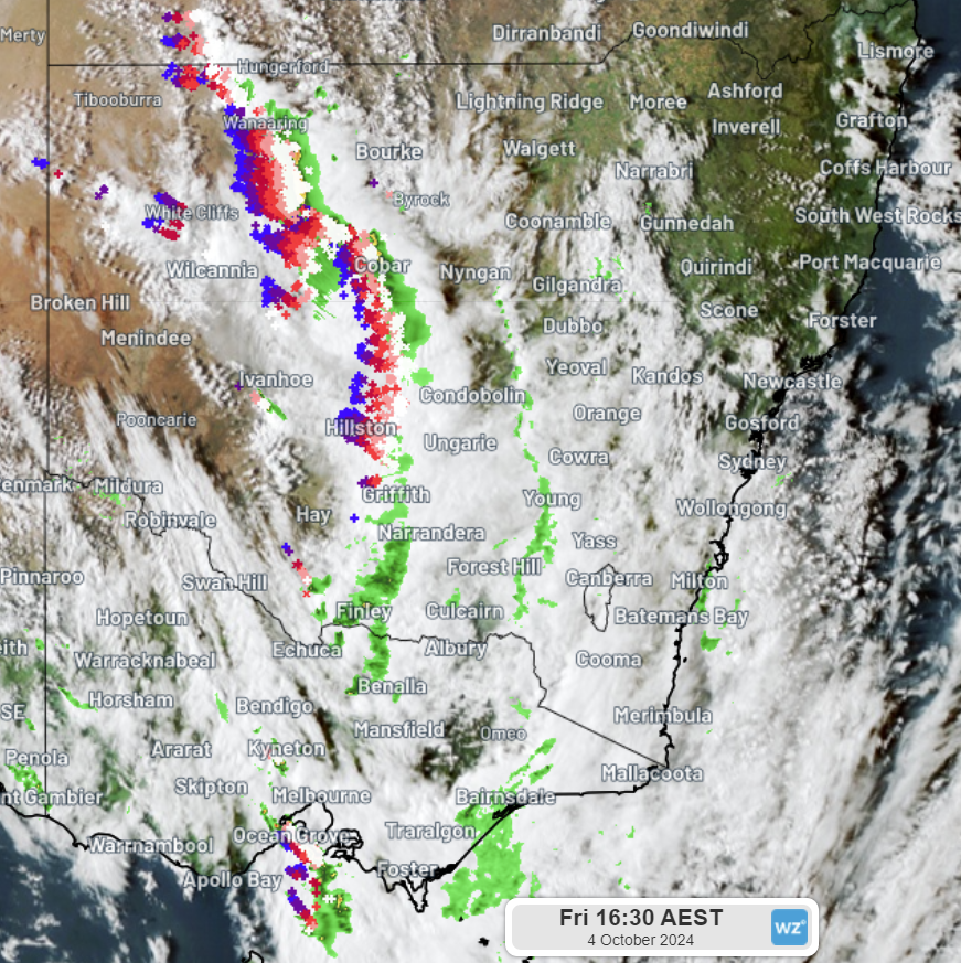 Image: Himawari satellite imagery with radar and lightning tracker data, showing the severe thunderstorms which brought a 91km/h wind gust to Cobar and 5mm of rain in 10 minutes to Geelong at 4:30pm AEST Friday, October 4, 2024.
 A second line of thunderstorms, which developed further south in the evening, delivered 7.8mm of rain in the 20 mins to 8pm at Narrandera. And in case you were in any doubt that the snow season is well and truly over in VIC, a series of thunderstorms delivered 18mm of rain to Falls Creek between 9:30pm to 12:30am, with 4.6mm of that falling in the 10 min prior to midnight.
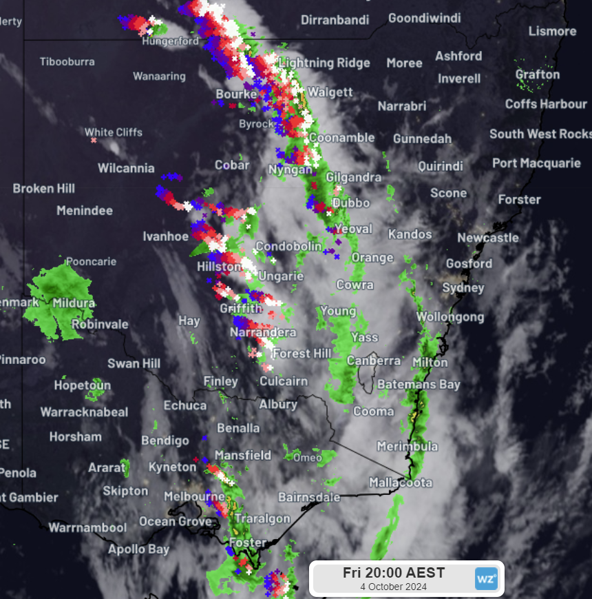 Image: Himawari satellite imagery with radar and lightning tracker data at 8pm AEST Friday, October 4, 2024, showing thunderstorms impacting Narrandera, NSW, and thunderstorms in Victoria which would later bring a bit of a downpour to Falls Creek, Vic.
 Today, the same trough which lit up NSW skies yesterday has shifted north, triggering thunderstorms in northern WA, the NT, QLD and northeast NSW, with severe thunderstorms in western QLD generating wind gusts of 120km/h at The Monument, about 130km southwest of Mount Isa, early this afternoon. A wind gust of 106km/h was then recorded at Mount Isa airport later in the afternoon.
Meanwhile, another cold front crossing the southeast is triggering further shower and thunderstorm activity over Victoria, with 5.6mm of rain falling in just 10 minutes this afternoon over Viewbank and Scoresby, both near Melbourne. Ballarat has also seen something of a heavy downpour this afternoon, recording 5.2mm of rain in 10 minutes.
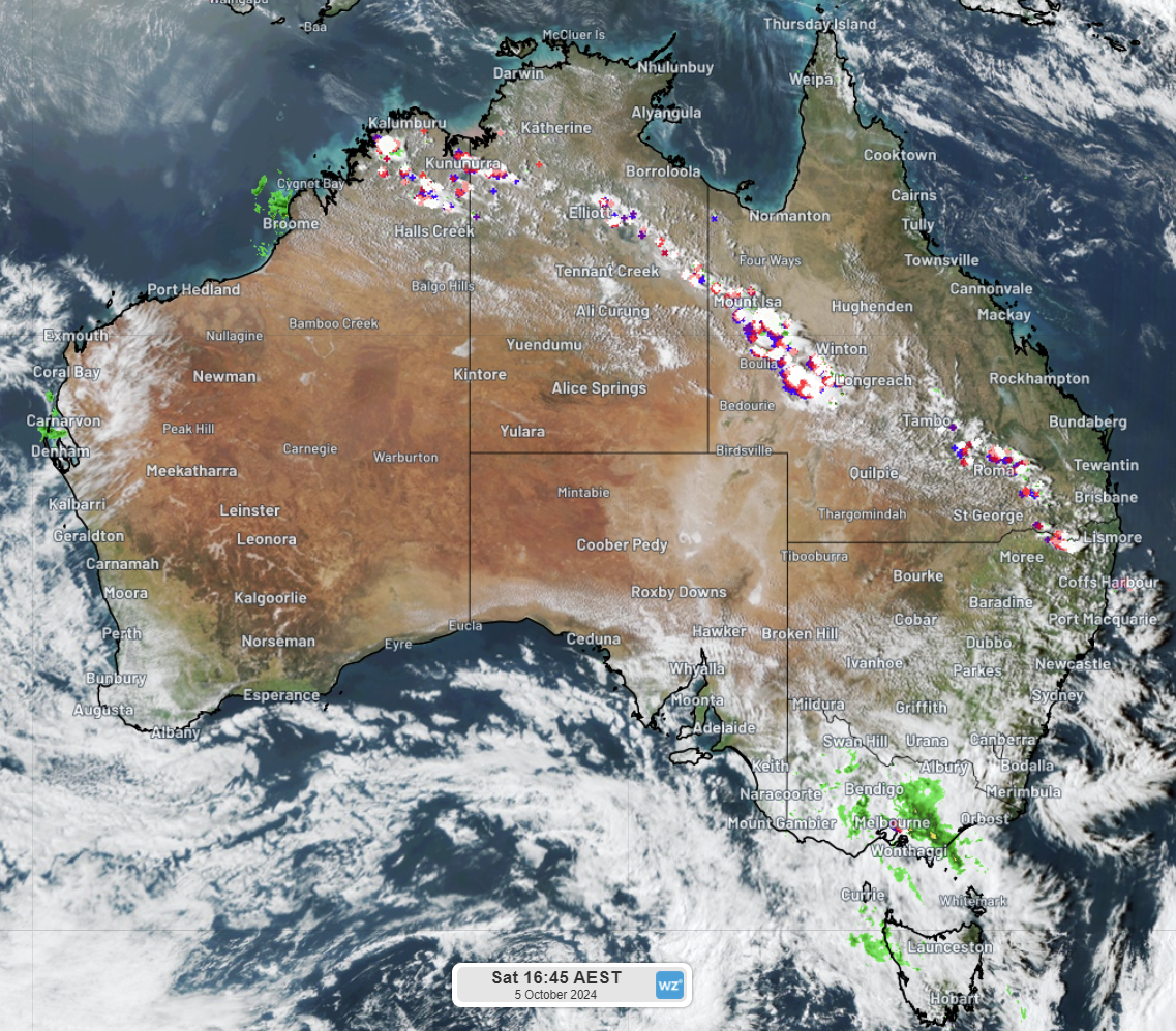 Image: Himawari satellite imagery with radar and lightning tracker data at 4:45pm, Saturday, October 5, 2024, showing thunderstorms stretching across the northern states and into northeast NSW, while rain and the odd thunderstorm impact Victoria.
 Thunderstorms will continue to impact northern states throughout the weekend, and a series of fronts will bring further rain and isolated thunderstorms to Victoria and Tasmania. With such active weather systems impacting the country over the long weekend, please remember to stay up to date with weather warnings.
- Other news
- Sat 05 Oct 2024 Heat intensifying early in Australia's northwest
- Fri 04 Oct 2024 Long weekend weather for the capital cities
- Fri 04 Oct 2024 Don't make this common daylight saving mistake
- Thu 03 Oct 2024 600 thousand lightning strikes in WA
- Thu 03 Oct 2024 Severe weather bearing down on South Australia