News
‹ back to weather news
News
-
Frosty mornings ahead as large high dominates
Anthony Sharwood, 29 April 2025Chilly early mornings will be a feature of the weather across most of Australia for the rest of the working week, as a large high pressure system parks itself south of the mainland.
While air circulating anti-clockwise around the high will push heavy showers onshore to parts of the east coast, most of the country will experience stable conditions with light winds. That means an outbreak of frosty mornings in the still, mostly clear air of mid-to-late autumn.
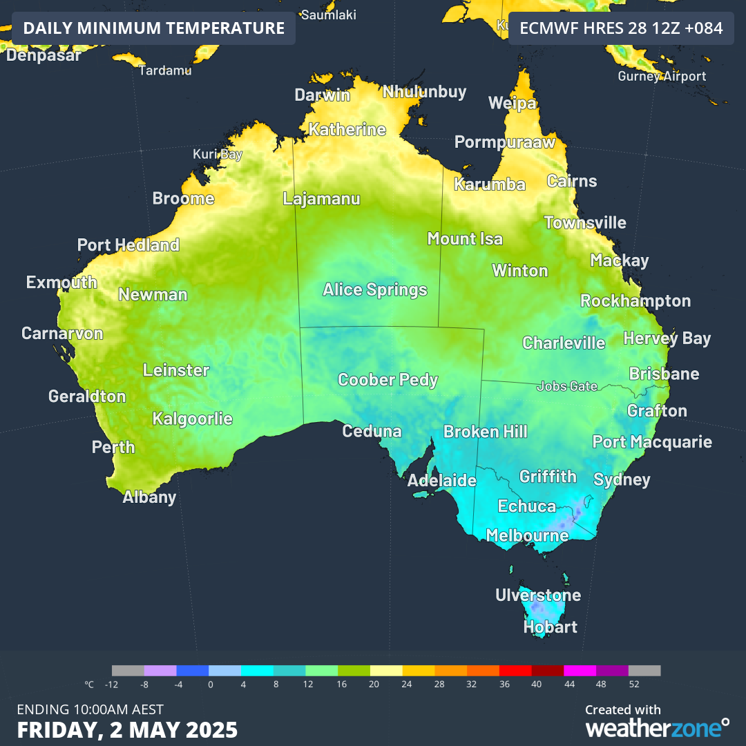
Image: Forecast minimum temperatures for Friday, May 2, 2025, according to the ECMWF model.
At least four states and territories can expect sub-zero minimums this week, with elevated parts of Tasmania, Victoria, NSW and the ACT all likely to see the grass turn crunchy on some or all of the mornings between Wednesday and Saturday.
In the plains and valleys below the high country in those states, some towns and cities could also see frost.
Canberra’s lowest minimums this week are expected to be 2°C on both Friday and Saturday mornings, but as mentioned in our recent story on Canberra frost, that’s cold enough for frost to form, as the ground is usually a couple of degrees cooler than the air directly above it where temperature measurements are taken.
The synoptic chart for Thursday shows the dominance of the high, with southeasterlies pushing moisture towards NSW and Victoria’s East Gippsland region, but virtually no rainfall anywhere else in the country.
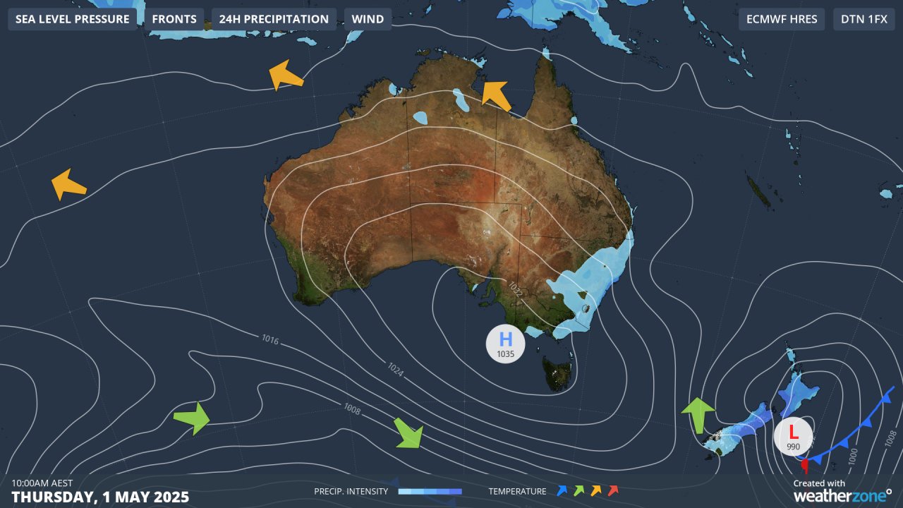
Image: Synoptic chart for Thursday, May 1, 2025.
A cold front will move towards southwest WA later in the week as the high drifts east, but its effects should remain localised at this stage. Aside from fronts clipping the south and wet weather over northeastern Queensland, next week's Australian weather again looks likely to be dominated by a large high pressure system.
Why the blocking highs?
While these large high pressure systems become more normal at this time of year, the ongoing pattern of blocking highs (highs that block the northwards track of Southern Ocean cold fronts) is consistent with the current positive Southern Annular Mode (SAM).
The SAM refers to the north-south movement of strong westerly winds that dominate the mid-to high-latitudes of the Southern Hemisphere.
With a positive SAM as we have now, these winds are positioned further south than usual, and highs tend to be the dominant feature.
READ MORE: Southern Annular Mode - What is the SAM and how does it affect Australia?
- Other news
- Tue 29 Apr 2025 Positive SAM and warm oceans dominate Australia's winter outlook
- Mon 28 Apr 2025 Wet week ahead for eastern NSW
- Mon 28 Apr 2025 Mesoscale low drenches NSW Hunter, Central Coast regions
- Sun 27 Apr 2025 NSW coast hit by heavy rain
- Sat 26 Apr 2025 Severe weather in SE Australia