News
‹ back to weather news
News
-
Positive SAM and warm oceans dominate Australia's winter outlook
Felix Levesque, 29 April 2025Australia's primary climate drivers are currently in a neutral phase, which means the weather around Australia is likely to be dominated by more local effects heading into winter.
Pacific Ocean climate driver
The El Niño Southern Oscillation (ENSO) has returned to a truer neutral phase, after trending towards a La Niña-like phase during summer. Sea Surface Temperatures (SST) across the central equatorial Pacific Ocean, in a region denoted as Niño3.4, can be seen returning closer to average in the image below, after trending colder than average during summer.
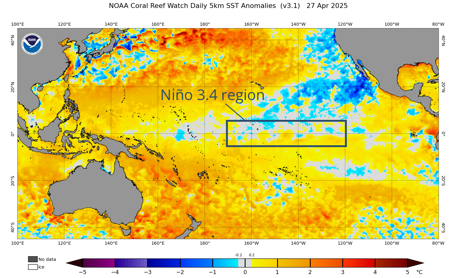
Image: Sea Surface Temperatures across the Pacific Ocean on April 27, 2025. Source: NOAA.
The La Niña signal was enough for the US’s Climate Prediction Center (CPC) to declare a La Niña event last January – but was not sustained enough for the Australian Bureau of Meteorology to follow suit, with a different set of thresholds. The CPC did declare the end of the La Niña event in mid-April, with the ENSO returning to neutral.
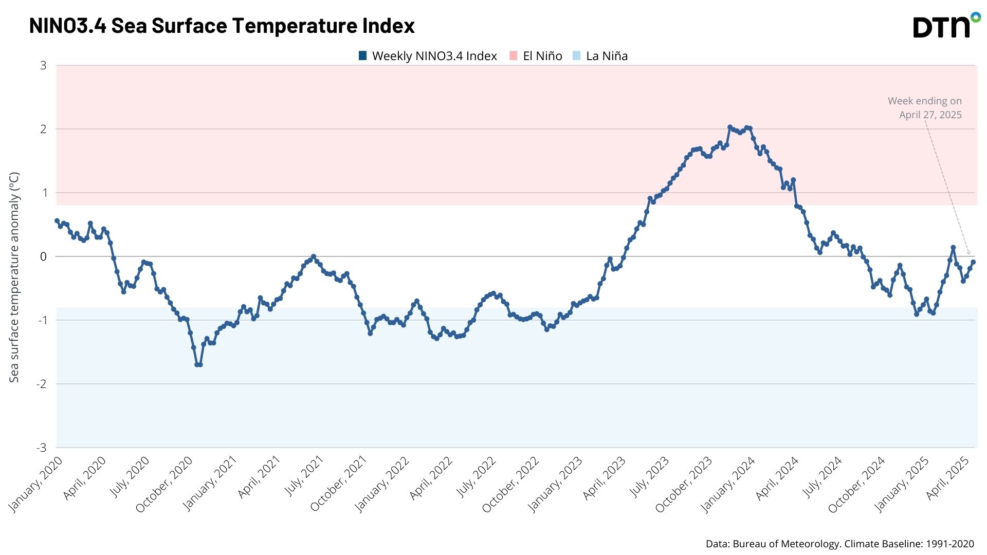
Image: Niño3.4 Sea Surface Temperature Index over the past 5 years.
The weak La Niña signal did influence the weather over Australia, especially over the east, bringing Queensland’s third wettest March on record. The ENSO is forecast to remain neutral (neither La Niña or El Niño) over the coming winter, limiting its impact on Australia’s weather.
Indian Ocean climate driver
The Indian Ocean Dipole (IOD) has remained in a neutral phase over the past few months. A negative IOD occurs when warmer than average SST lie to the northwest of Australia, and cooler than average waters extend over the western Indian Ocean, near the Horn of Africa. The warm waters near Australia promote increased rainfall, especially over the north and interior. A positive IOD sees the reverse, with cooler waters sitting near Australia, and a reduction in rainfall moving east and south over the country.
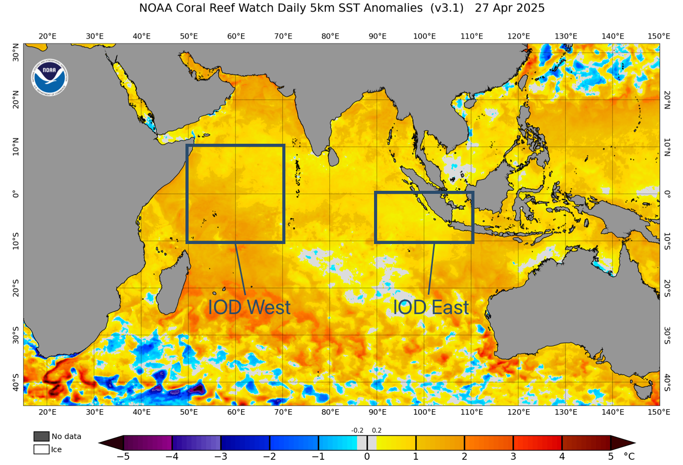
Image: Sea Surface Temperatures across the Indian Ocean on April 27, 2025. Source: NOAA.
The IOD is expected to remain neutral over the coming winter, but early indications hint towards warming oceans off Indonesia and northwest Australia during the late winter and spring period. These warm waters come through the Indonesian Throughflow as water moves from the Pacific Basin to the Indian Ocean bringing increased chances of a negative IOD developing later this year.
Southern Annular Mode (SAM)
The SAM modulates the northwards extent of the westerly belt over the Southern Ocean. In a negative phase, the SAM promotes cold fronts further north over Australia, bringing increased rainfall to southern Australia. The SAM has however seen strong periods of the positive phase over recent months, promoting block high pressure patterns over southern Australia, keeping cold fronts well to the south.
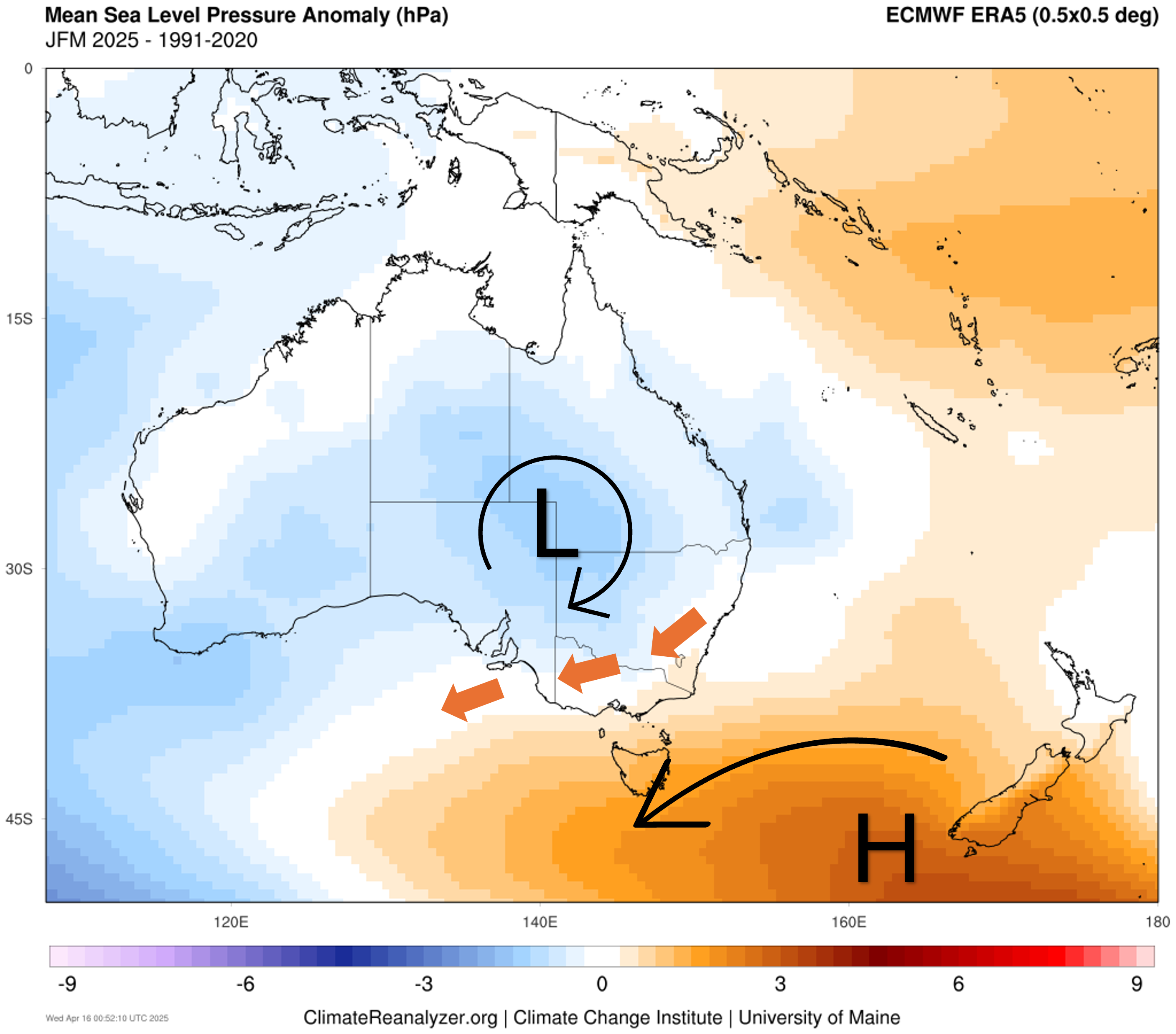
Image: Annotated mean sea level pressure anomaly for the first three months of 2025. Source: ClimateReanalyzer
The blocking high pattern has maintained severe rainfall deficiencies over South Australia, Victoria and Tasmania, while promoting increased onshore flow and rainfall over eastern Australia.
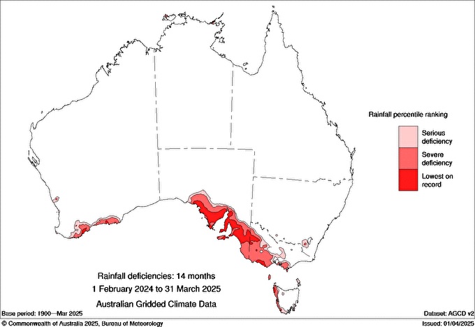
Image: Rainfall deficiencies in Australia from February 1 2024 to 31 March 2025. Source: BoM.
READ MORE: Adelaide's driest start to the year since the 1980s
Warm temperatures have also been maintained over the southeast of the country. Adelaide, Melbourne, Canberra and Sydney are each running around 3°C above the long term average maximum temperature for April.
Looking at the pressure anomaly map below, higher than average pressure over Australia’s southeast is expected to persist through May and the start of winter, signalling a continuation of this positive SAM tendency. This could prolong the rainfall deficiencies plaguing southern Australia during what is usually the wettest months of the year – a bad sign for water supply and the agriculture sector.
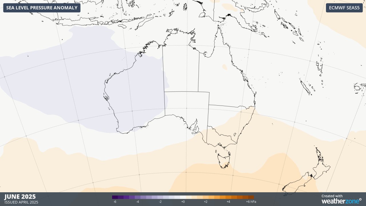
Image: Sea Level Pressure anomalies for June 2025.
Warm Sea Surface Temperatures (SST) around Australia
The map below shows a continuation of the extremely warm SST anomalies all around Australia over the past months.
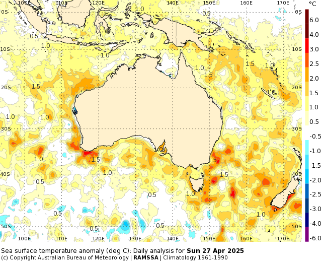
Image: Above average SST surrounding Australia on April 27, 2025. Source: BoM.
The increased atmospheric moisture available due to these very warm SST has promoted above average rainfall over northern and eastern Australia in the past few months. A continuation of these warm waters should maintain above average rainfall across eastern Australia, potentially also over Western Australia as more fronts may cross into the west. Southern Australia would be primed for increased rainfall, however the lack of frontal passages picking up this moisture should limit this potential – for now.
Overall, seas around Australia are expected to remain much warmer than average in the coming months, fuelling thunderstorms and heavy rainfall events well into this year.
What to expect this winter
In the absence of any climate drivers in the Pacific and Indian Oceans, Australia's weather will be more strongly influenced by the SAM and local sea surface temperatures in the coming months.
Higher than normal mean sea level pressure to the south of Australia could continue to cause drier-than-average weather across already parched areas of southern Australia this winter. By contrast, abnormally warm seas could promote above average rainfall in parts of eastern and western Australia.
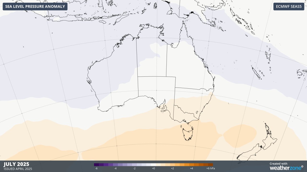
Image: Sea Level Pressure anomalies for July 2025.
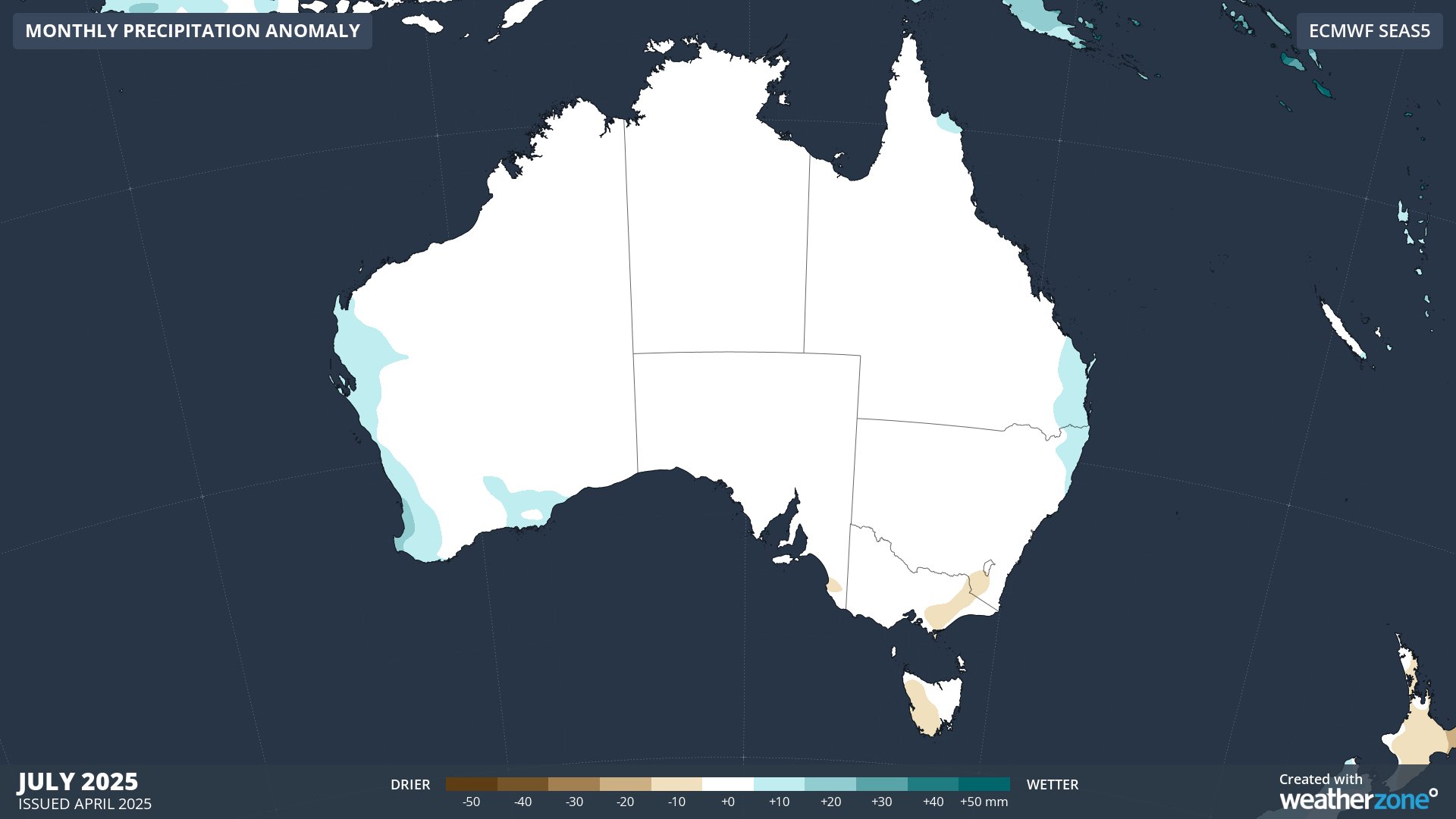
Image: Monthly precipitation anomalies for July 2025.
Temperatures are expected to be warmer than average for most of Australia in the coming months, although increased cloud cover might help suppress daytime warmth in parts of Queensland and northern NSW.
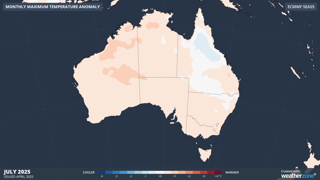
Image: Monthly maximum temperature anomalies for July 2025.
- Other news
- Tue 29 Apr 2025 Frosty mornings ahead as large high dominates
- Mon 28 Apr 2025 Wet week ahead for eastern NSW
- Mon 28 Apr 2025 Mesoscale low drenches NSW Hunter, Central Coast regions
- Sun 27 Apr 2025 NSW coast hit by heavy rain
- Sat 26 Apr 2025 Severe weather in SE Australia