News
‹ back to weather news
News
-
Severe storms possible in southeast Qld today
Weatherzone Staff, 19 October 2024This afternoon and early evening, southeast Queensland, along with southern inland areas and northwestern parts of the state, can expect isolated severe storms as a trough moves through, bringing the potential for damaging winds, heavy rainfall, and large hail.
These storms will form from the interaction of humid northerly to northeasterly winds from the Coral Sea with drier westerly to southwesterly winds from the interior. Hot winds are pushing temperatures above 30°C across many regions, creating instability in the lower atmosphere and setting the stage for storm development.
As the afternoon progresses, severe thunderstorms may impact regions such as the Southeast Coast, Wide Bay and Burnett, Central Highlands, Capricornia, and Central West districts, including the Sunshine Coast.
It's important to stay informed about weather updates and warnings as the situation evolves, ensuring you're prepared for any potential impacts from these storms.
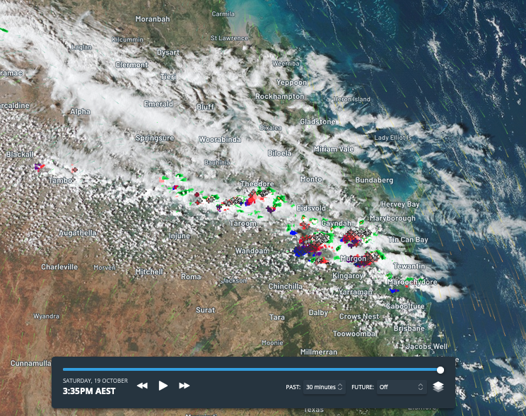
Storms developing in southeast Qld this afternoon (Sat 19th October).
- Other news
- Tue 22 Oct 2024 Melbourne's warmest day since March
- Mon 21 Oct 2024 Warm start to the week in southern Australia
- Sun 20 Oct 2024 Very dry, gusty winds to elevate fire risk this week
- Sun 20 Oct 2024 How hot oceans affect the upcoming Australia tropical cyclone season
- Sat 19 Oct 2024 Sunshine State sizzles