News
‹ back to weather news
News
-
Soggy week ahead for the east coast
Anthony Sharwood, 22 April 2025Don’t go anywhere without an umbrella in coming days if you live along the NSW coast or nearby parts of Queensland and Victoria.
A persistent feed of moisture from the Tasman Sea is already generating intermittent areas of heavy rain along the NSW coast, and this pattern will continue throughout the abbreviated working week.
The moisture potential of the onshore flow is being enhanced by warm sea surface temperatures off the east coast.
Autumn in Australia is typically when we see the warmest sea surface temperatures – the lag occurs because water takes longer than air to heat up or cool down.
But this year, the sea surface is much warmer than usual, with anomalies of a degree or more around virtually the entire continent, while waters off much of the NSW coast are around two degrees warmer than usual.
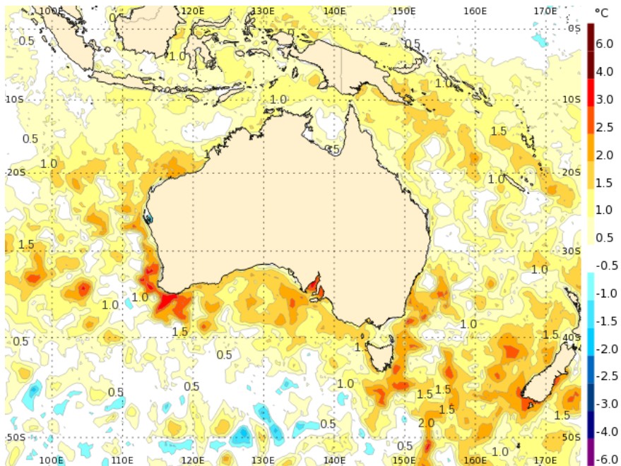
Image: Australian sea surface temperature anomalies on April 21, 2025. Source: BoM.
That all adds up to rain, and plenty of it.
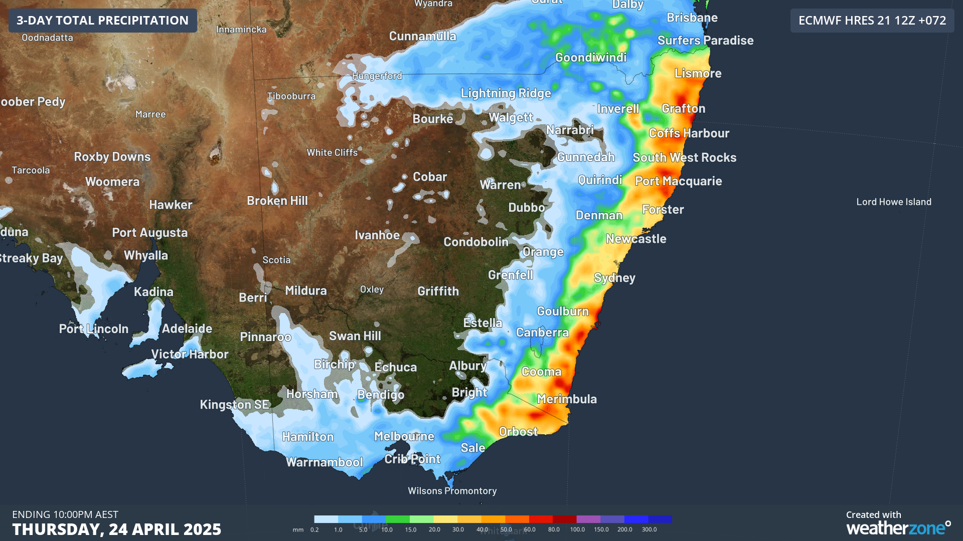
Image: Predicted accumulated rainfall to 10pm Thursday, April 24, 2025, according to the ECMWF model.
As you can see on the map above, falls of 60-80mm (the red areas) can be expected in the next couple of days along virtually the entire NSW coastline and adjacent areas.
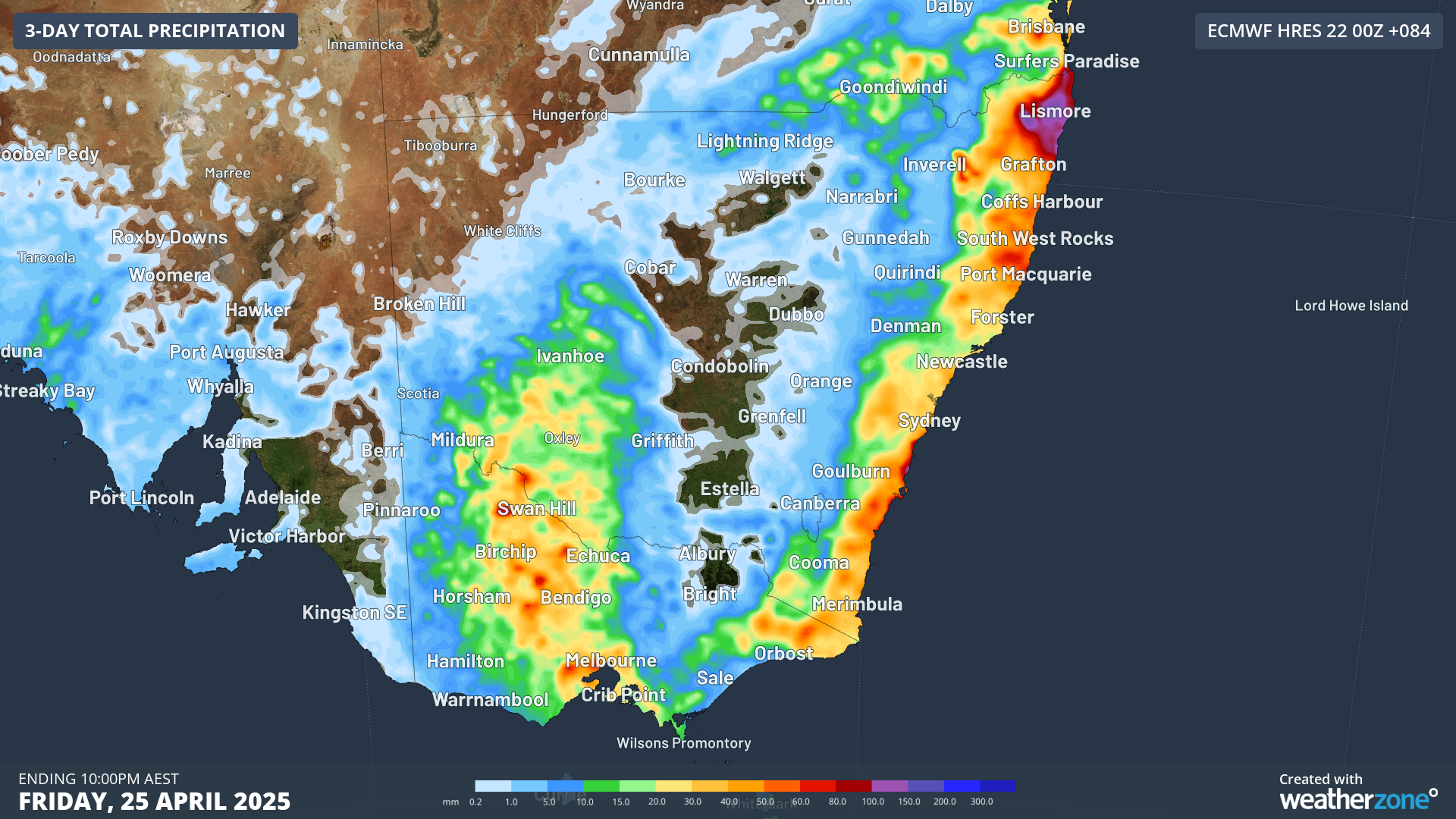
Image: Predicted accumulated rainfall across southeastern Australia to 10pm on Friday, April 25, 2025, according to the ECMWF model.
If you extend the date range to Friday night (see map above), you’ll see that parts of NSW and Victoria beyond the coast are in line for decent falls, which are much-needed in many inland areas.
The secondary burst of rain is expected to arrive late in the week as a cold front and associated trough move in from the west, with possible embedded thunderstorms that could enhance rainfall potential across southeastern Australia, including Victoria, New South Wales, and parts of eastern South Australia.
This may be followed by a potential gusty southerly change along the NSW coast early next week as the system moves offshore.
- Other news
- Wed 23 Apr 2025 Scorching heatwave intensifies over northern India
- Tue 22 Apr 2025 Nearly a million lightning strikes on wild NSW night
- Mon 21 Apr 2025 Easter bunny spotted in Australia's weather forecasts
- Sun 20 Apr 2025 ANZAC Day cold front all set
- Sun 20 Apr 2025 New data shows March 2025 was Earth's warmest on record