News
‹ back to weather news
News
-
Spectacular spiral low and outback storms
Anthony Sharwood, 26 November 2024Satellite images have captured a line of thunderstorms marching across outback South Australia overnight and into Tuesday morning, while a strong low pressure system can also be seen spinning off the country's south coast.
The storms formed along a low pressure trough associated with the low and it’s likely that some heavy rainfall totals were received in parts of South Australia's parched West Coast and North West Pastoral forecast districts.
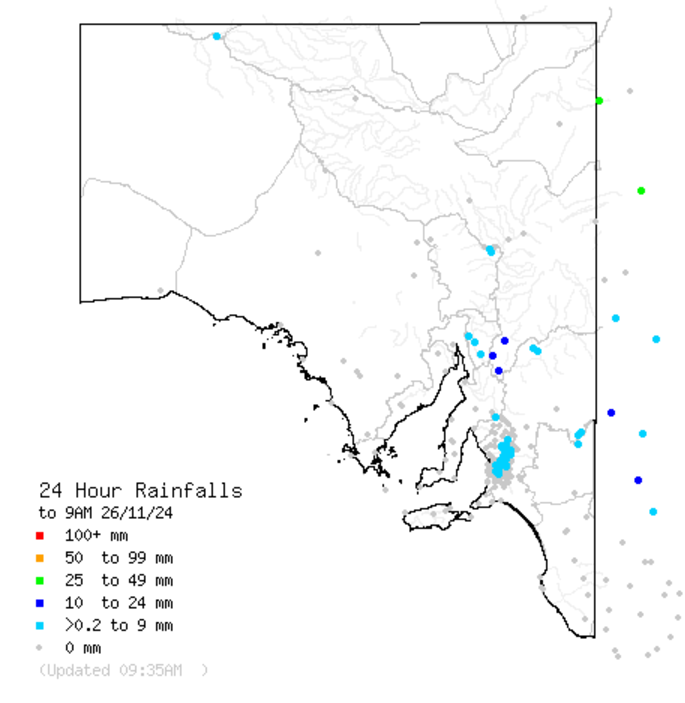
We use the word "likely" because there are very few official weather stations to record totals in the areas where radar and lightning strike observations suggest heavy rain may have fallen.

Image: The BoM’s daily update for 24-hr rainfall totals for 9am shows no significant measurements in regions through which the storms passed early on Tuesday morning, due to a lack of weather stations. Source: BoM.
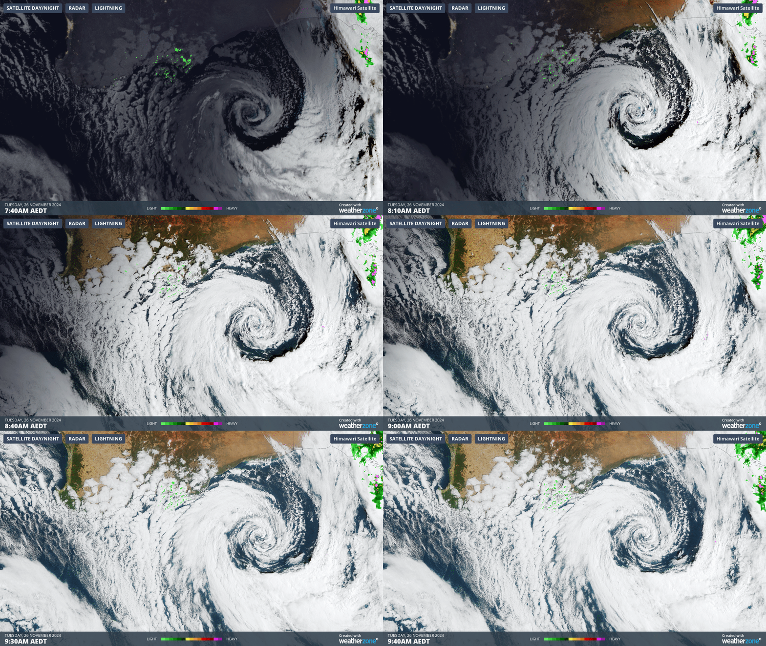
Meanwhile it's worth taking a close-up view of that low on a 2-hour loop of combined satellite and radar imagery on Tuesday morning.

Image: Spiral low pressure system south of WA early on the morning of November 26, 2024.
Seen from space, that low is a beautiful beast. In terms of the weather at ground level, its effects are twofold:
- To the west of the low, the tell-tale speckled cloudmass is indicative of the airmass’s Southern Ocean origins. This frigid air is being funnelled towards southwest WA, with Albany heading for a maximum of just 16°C today.
- To the east is the stormy outbreak mentioned above with warm humid air tracking ahead of the low and associated trough.
Overall, this outbreak of stormy weather in remote parts of SA is indicative of atmospheric instability which will spread across some other parts of Australia as the week progresses, delivering potentially heavy falls to a widespread area of eastern Australia.
- Other news
- Wed 27 Nov 2024 Severe storms to strike eastern Australia
- Wed 27 Nov 2024 How Sydney Airport was the hottest place in the world on Wednesday
- Wed 27 Nov 2024 Statewide soaking for Victoria
- Tue 26 Nov 2024 Australia's first tropical cyclone of the season could form this week
- Mon 25 Nov 2024 Severe heatwave takes hold of NSW

