News
‹ back to weather news
News
-
Thunderstorms, heavy rain and heatwave to hit Australia this week
Ben Domensino, 18 November 2024It’s going to be another big week of severe weather in Australia, with widespread thunderstorms hitting multiple states, heavy rain drenching central Queensland and a heatwave spreading across southern Australia.
Late-spring is always a volatile time for weather in Australia and this month is living up to that reputation.
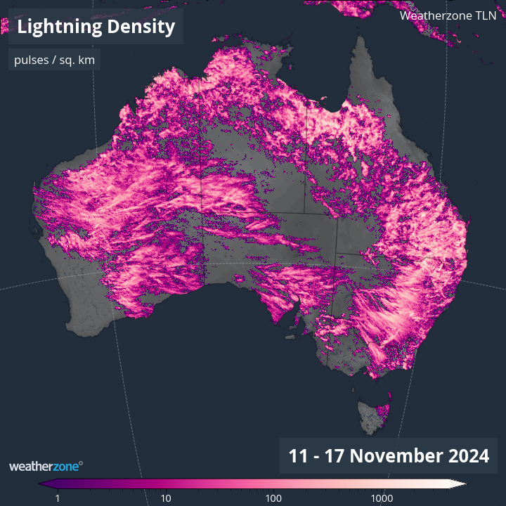
Last week, daily thunderstorm activity produced 12.78 million lightning strikes over Australia, with more than 2.5 million of these occurring on Sunday alone.

Image: Observed lightning density during the week ending on November 17, 2024.
This prolific thunderstorm activity will continue this week, with daily storms likely to hit multiple states and territories.
Thunderstorms in Australia this week
Storms will occur over large areas of the county this week due to broad areas of low pressure interacting with copious airborne moisture and widespread atmospheric instability.
This week’s storms will mainly affect parts of NSW, Qld, the NT and WA between Monday and Friday, before also spreading to parts of southern Australia from the weekend.
As we saw last week, severe thunderstorms are a good chance on most days this week, so be sure to keep up to date with the latest severe thunderstorm warnings in your state or territory.
Heavy rain in central Queensland
Rain will increase over Qld from the middle of this week as moisture-laden easterly winds feed into a deepening coastal trough. This rain will start on Wednesday and could increase on Thursday as the coastal trough deepens. Some models even suggest that a low pressure system could form near the central coast of Qld around Thursday, which would further enhance the risk of heavy rain and flooding.
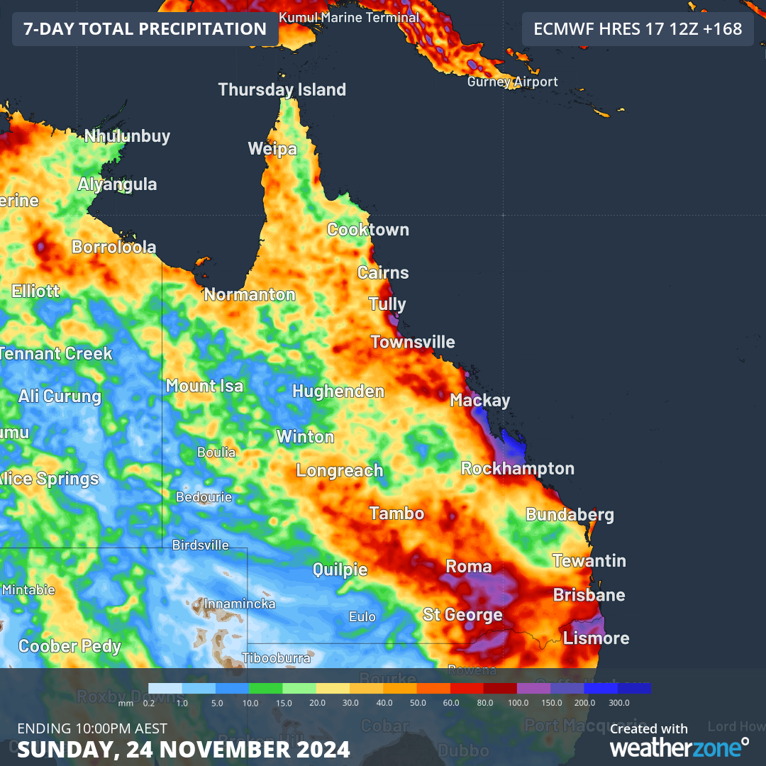
The image below shows one computer model’s prediction for accumulated rain this week, showing potential for more than 200 mm of rain along parts of Qld’s central coastline.

Image: Forecast accumulated rain during the 7 days ending at 10pm AEST on Sunday, November 24, 2024.
While there is still some uncertainty regarding this week’s rain in central Qld, there is potential for heavy rain and flooding in the state’s central coastal districts around Thursday.
Heat in southern Australia
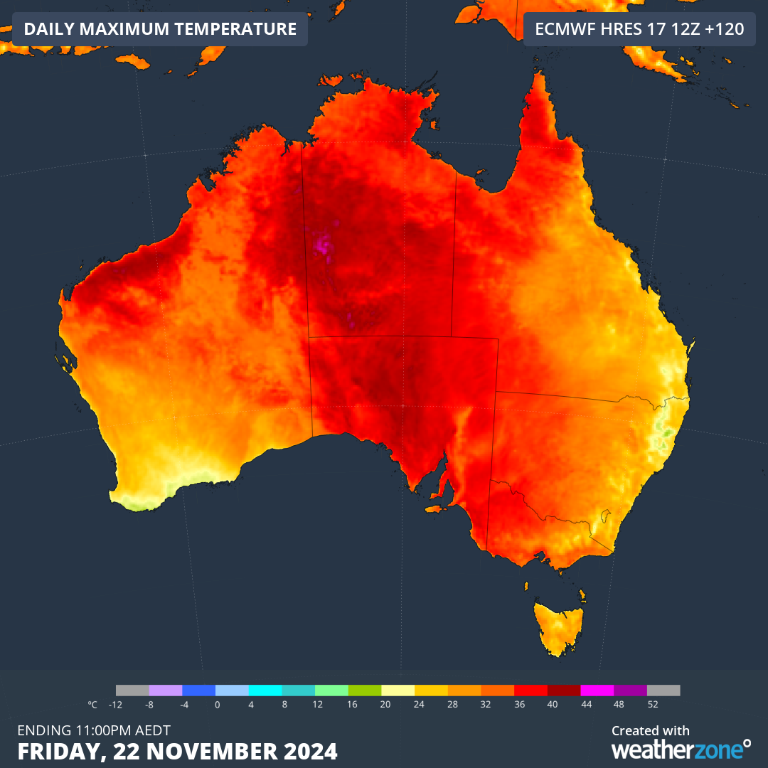
Another standout feature of this week’s weather will be a pulse of hot air spreading over the country’s south and southeast in the second half of the week.
Northerly winds developing ahead of a low pressure trough will draw hot air from central Australia towards the country’s southern coastline from Thursday. This heat will linger for at least two days and nights, with some models suggesting it could persist until Sunday.
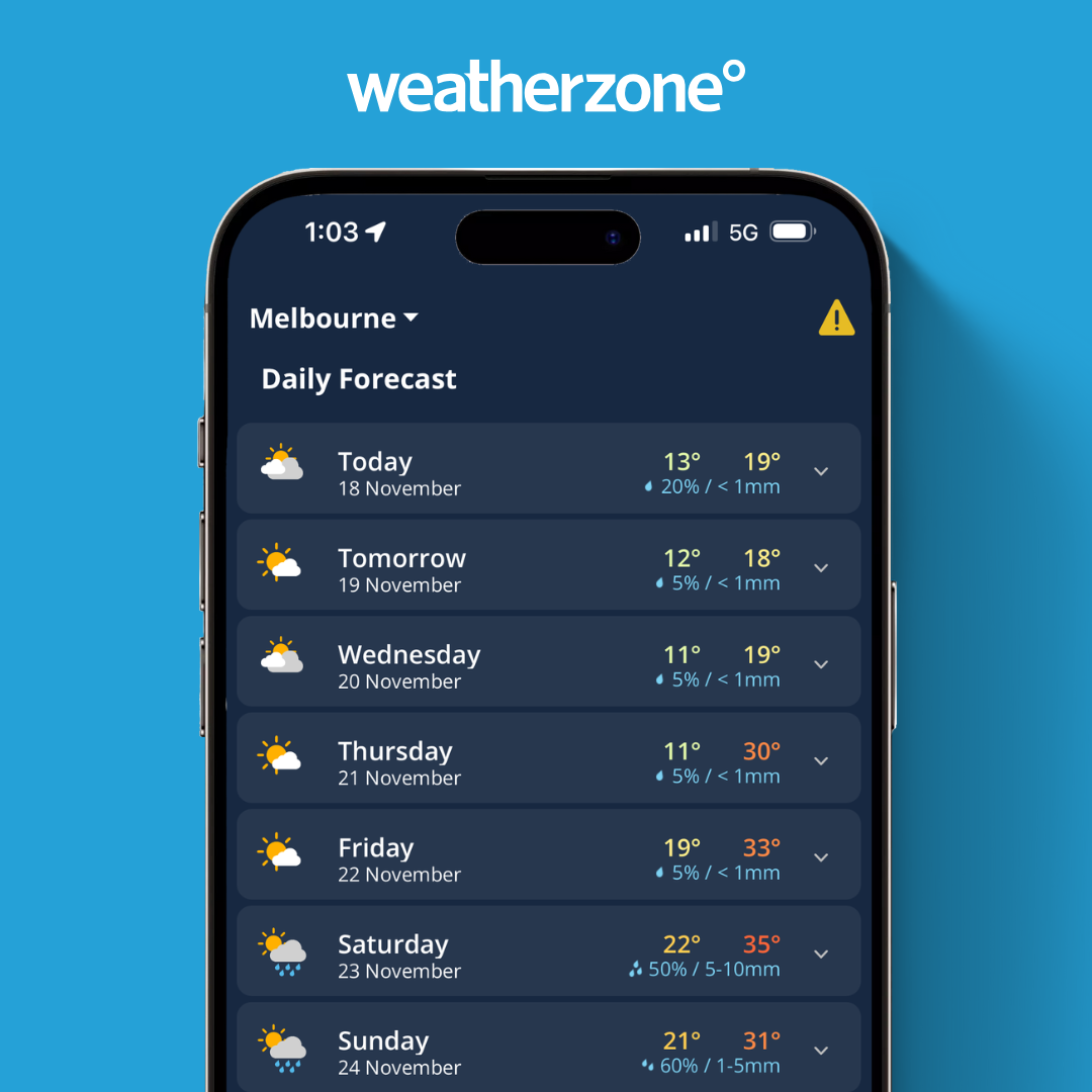
Image: Daily forecast on the Weatherzone app for Melbourne, Vic, as at November 18, 2024.
Adelaide and Melbourne could both see four days at or above 30°C between Thursday and Sunday, along with a string of abnormally warm nights.
The impending warmth may be intense and persistent enough to be classified as a severe heatwave in some areas of SA and Vic.

Image: Forecast maximum temperature on Friday, November 22, 2024.
Unfortunately, the rising temperatures will also see a return of elevated fire danger in SA and Vic towards the end of this week, possibly causing extreme fire danger ratings in some areas.
- Other news
- Mon 25 Nov 2024 Severe heatwave takes hold of NSW
- Mon 25 Nov 2024 Heaviest rain in almost three years in Victorian city
- Mon 25 Nov 2024 Big stormy end to spring looms for Australia
- Sun 24 Nov 2024 Nature’s air conditioner: how the seabreeze will help Sydney cope during the heatwave
- Sat 23 Nov 2024 Ever Wondered Why It Takes Longer to Fly from Brisbane to Perth Than the Other Way? Here’s the Surprising Reason!


