News
‹ back to weather news
News
-
How a West Australian cyclone saturated Queensland
Anthony Sharwood, 2 April 2025Heavy rain and flood warnings are in the news again today in Queensland – including in Brisbane and the heavily populated southeast corner of the state – due to the remnants of Tropical Cyclone Dianne.
Dianne made landfall on WA's Kimberley coastline on Saturday morning. So how is it responsible for soaking parts of Queensland and even northern NSW several days later – when some of those areas are as far as 3000 kilometres from the Kimberley?
The answer is that the remnant moisture from TC Dianne was picked up by the subtropical jet stream and rapidly transported towards Queensland, via Central Australia.
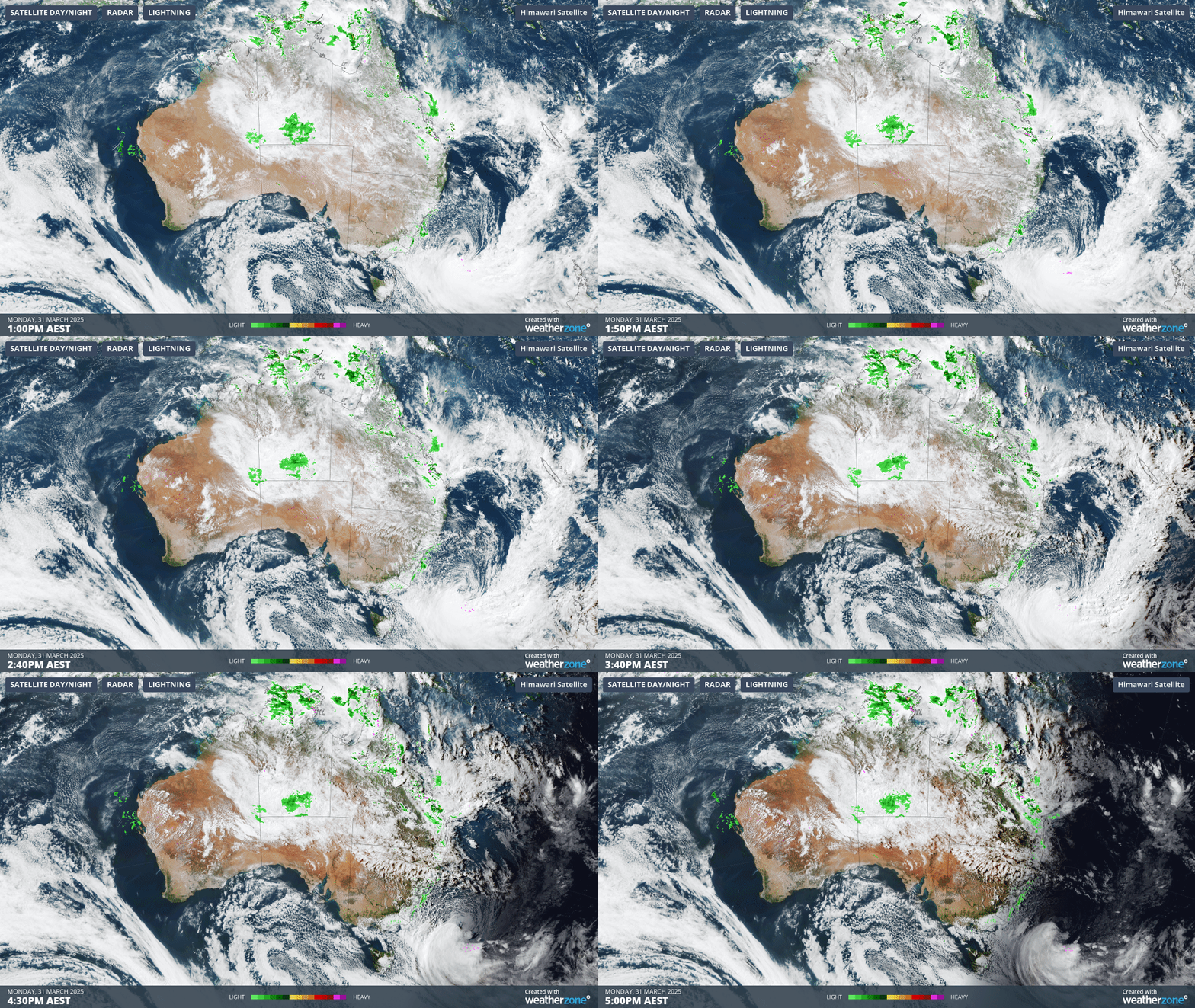
The 4-hour loop below shows moisture streaming across the country associated with the remnants of the former cyclone on Monday.

Image: Combined Australian satellite and radar loop between 1pm and 5pm (AEST) on Monday March 31, 2025.
Monday was the day when many outback localities received significant rainfall from this system, including Alice Springs with 50.8mm in the 24 hours to 9am Monday.
The rain would have been welcome, as Alice Springs missed out on last week's deluge that soaked large parts of outback and central Qld, as well as parts of outback SA and NSW.
Indeed the 50.8mm that Alice Springs received this Monday was more rain in a single day than the town had received over the course of any entire month going back 12 months.
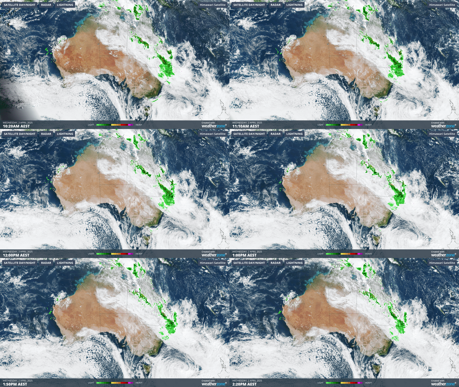
By Tuesday, Central Queensland was getting yet another soaking, with 24-hour totals of 100mm at multiple locations, and by Wednesday morning, rain had spread all the way to southeast Qld and northeast NSW, with Brisbane receiving 34.6mm between 9am and 3:30pm (AEST) Wednesday.

Image: Combined Australian satellite and radar loop around the middle of the day on Wednesday, April 2, 2025.
Most of the moisture from ex-TC Dianne should have completed its trans-continental journey and moved offshore by Thursday, although showers remain likely in many parts of Queensland on Thursday and Friday, as the trough across central and northern parts of the state lingers.
Western and interior Queensland should return to much drier conditions from the weekend onwards.
- Other news
- Thu 03 Apr 2025 Clouds clear to reveal immense scale of Queensland flooding
- Thu 03 Apr 2025 Daylight saving ends: how to remember which way to turn your clocks
- Thu 03 Apr 2025 Why Queensland has been getting all the rain
- Wed 02 Apr 2025 Damaging surf battering NSW coast
- Tue 01 Apr 2025 Australia's hottest and 4th-wettest March on record

