News
‹ back to weather news
News
-
Easter bunny spotted in Australia's weather forecasts
Quincy Tut, 21 April 2025The Easter bunny may have made its rounds delivering chocolate across the country during Easter Sunday, but that hasn't stopped its sneaky appearance elsewhere.
From west to east across the country, our weather models are painting pictures of our beloved creature in various forms of forecast parameters, from temperature to wind speed, or rain to dew points. Can you spot them all?

Image: The easter bunny is leaving its mark on the country's forecast in the coming days. Source: istockphoto.com/StockSeller_ukr
First up, some interesting weather is expected on Tuesday for eastern NSW following some warm Easter weather. A southerly change will move through eastern NSW in the wake of a cold front during Tuesday. The cool air mass brought with an upper-level feature will increase showers through the region, allowing daytime maxima to not rise above the mid-teens for some elevated areas.
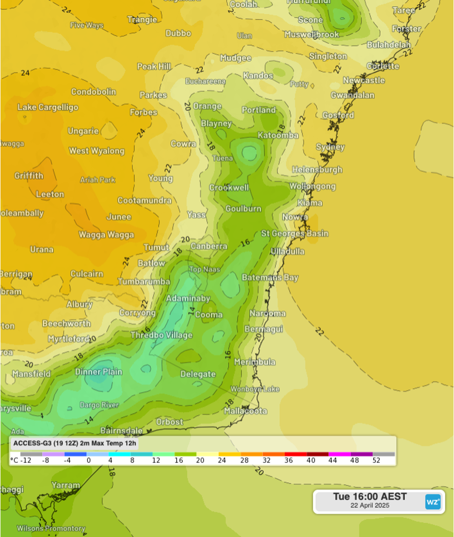
Figure: maximum temperatures across southeastern NSW and eastern Vic to Tuesday 4pm AEST using the ACCESS-G3 model.
As the front moves east into the Tasman Sea and develops into a cutoff low, rainfall totals are expected to increase along the NSW South Coast, with totals possibly exceeding 100mm in 24 hours in some areas. However, the most significant totals will be well offshore and towards Lord Howe Island.
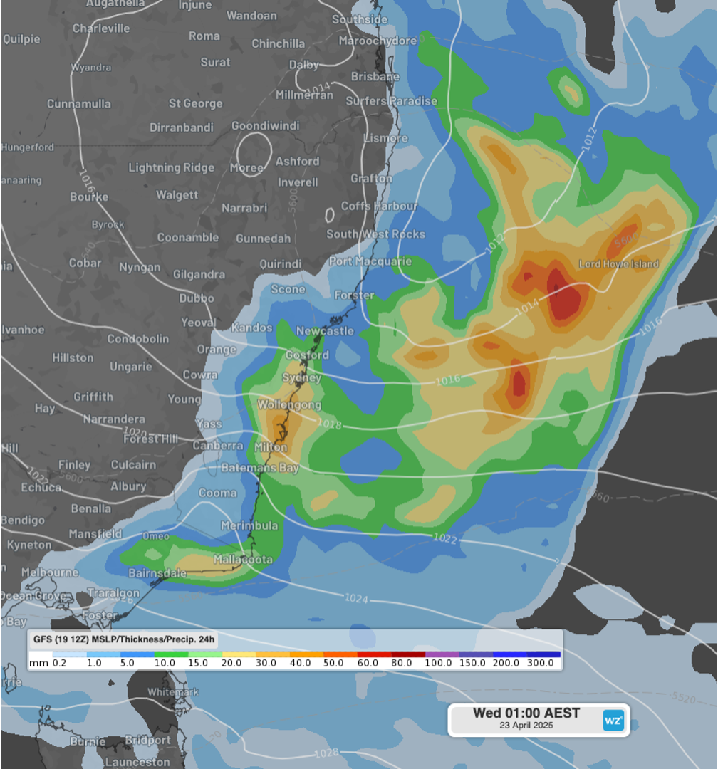
Figure: 24-hour rainfall over NSW and the Tasman Sea to Wednesday 1am AEST using the GFS model.
Hopping over to the west, a cold front is expected to cross southwestern WA during Wednesday, bringing the first rainfall in up to a week for some areas. Potentially severe thunderstorms are also expected with an upper-level feature moving from the coastline to further inland throughout the day. However, sustained winds ahead of the front will be strongest about the exposed coast.
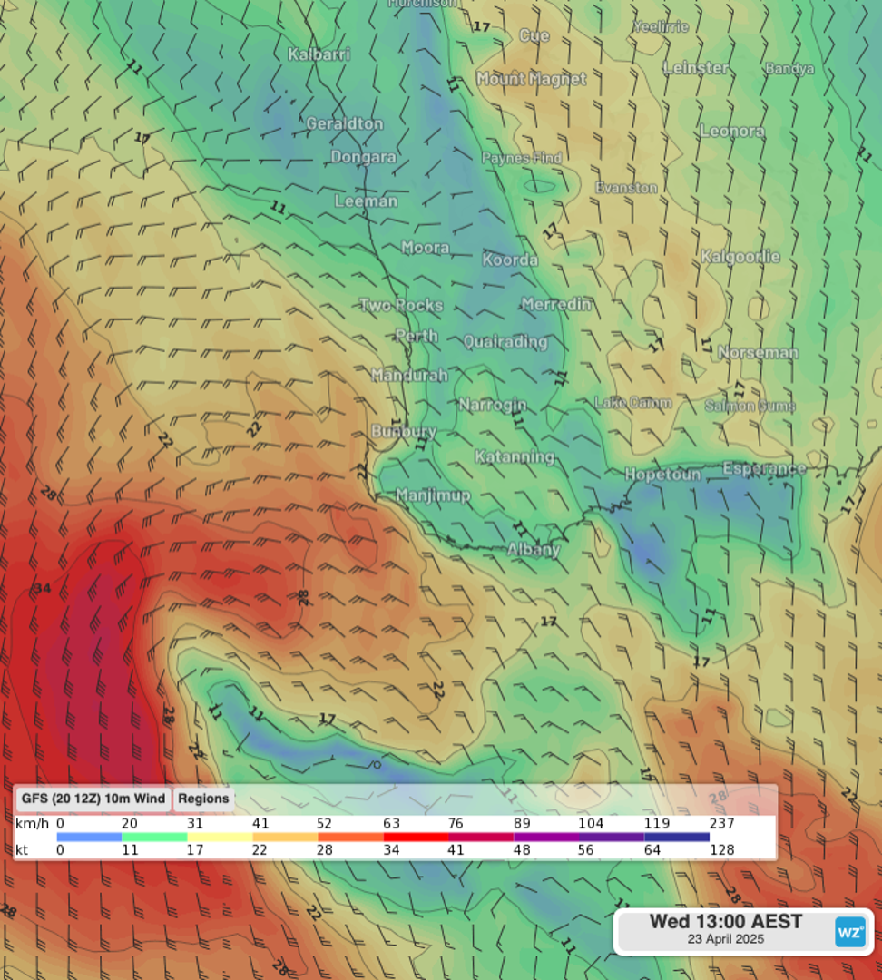
Figure: Near-surface wind speed over southwest WA 11am AWST on Wednesday using the GFS model.
Staying in the west, but venturing further north to WA's Gascoyne region, maximum temperatures have averaged about 2-4 degrees above average over the past week. Warmth is expected to linger, including during the nights and mornings, with warm easterly winds blowing through.
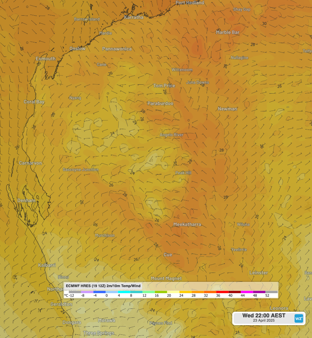
Figure: Near-surface wind speed and temperature for central-west WA at 8pm AWST on Wednesday using the ECMWF model.
Finally, dipping to the south, moist southerly winds are expected to transition into drier winds from the interior throughout this week. Dewpoints are expected to drop, particularly overnight, which will also allow for chillier temperatures, possibly in the single digits during the mid-week.
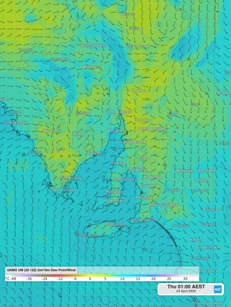
Figure: Near-surface wind speed and dewpoint temperature for eastern and central SA at 12:30am ACST on Thursday using the UKMO model.
So wherever you may be, we hope your Easter and long weekend has been enjoyable. Keep an eye on how forecasts develop throughout the week on our website.
- Other news
- Sun 20 Apr 2025 ANZAC Day cold front all set
- Sun 20 Apr 2025 New data shows March 2025 was Earth's warmest on record
- Sat 19 Apr 2025 Ex-Tropical Cyclone Tam brings huge waves to NSW coast on Good Friday
- Fri 18 Apr 2025 Sydney Royal Easter Show forecast
- Thu 17 Apr 2025 Your Easter capital city weather forecasts