News
‹ back to weather news
News
-
NSW coast hit by heavy rain
Aline Ribeiro, 27 April 2025A deep low pressure system over the NSW coast is generating heavy rainfall, thunderstorms and gusty winds over the central north of the state this Sunday.
Moparrabah, a locality on the Mid North Coast, received 112mm of rain in the last 24 hours, almost twice the average for April. Rain continues to fall in parts of the state, with the accumulated totals starting to mount up.
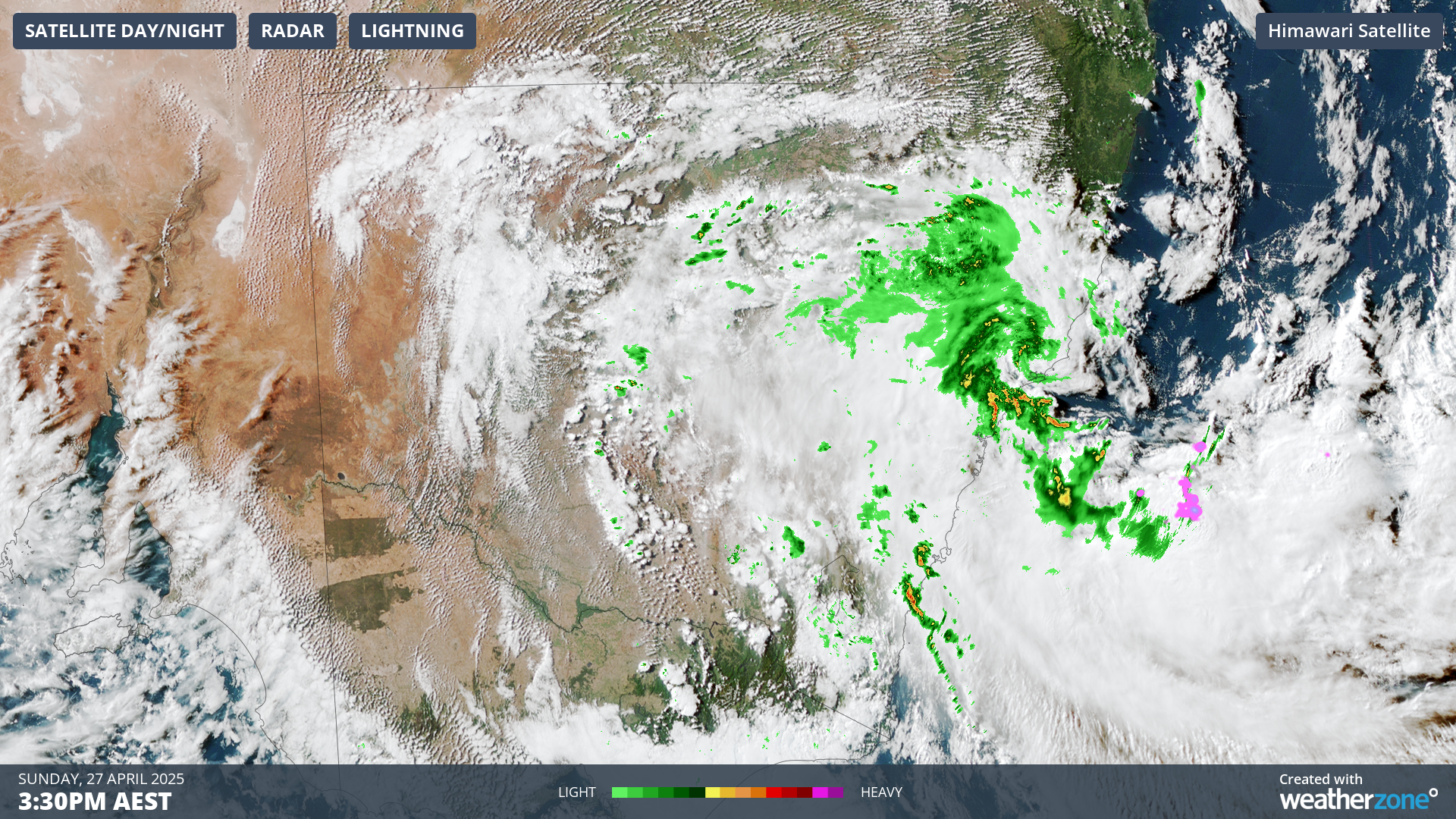 Image: Satellite imagery over southeast Australia on Sunday afternoon. Source: Weatherzone
 Looking ahead, more rainfall is expected for the next few days, at least for the coastal areas.
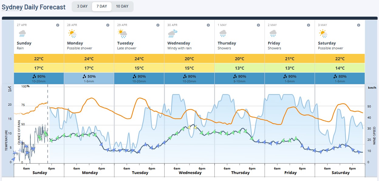
Image: Sydney daily forecast. Source: Weatherzone
The low pressure system will slowly move eastwards from tomorrow as a ridge of high pressure dominates the state. A weak trough will cross the southeast mid-week, causing showers in the south, east and central areas. Otherwise, most of the state will see clear skies and drier days. For the coastal regions, moist southerly winds will keep a high chance of showers over the next week.
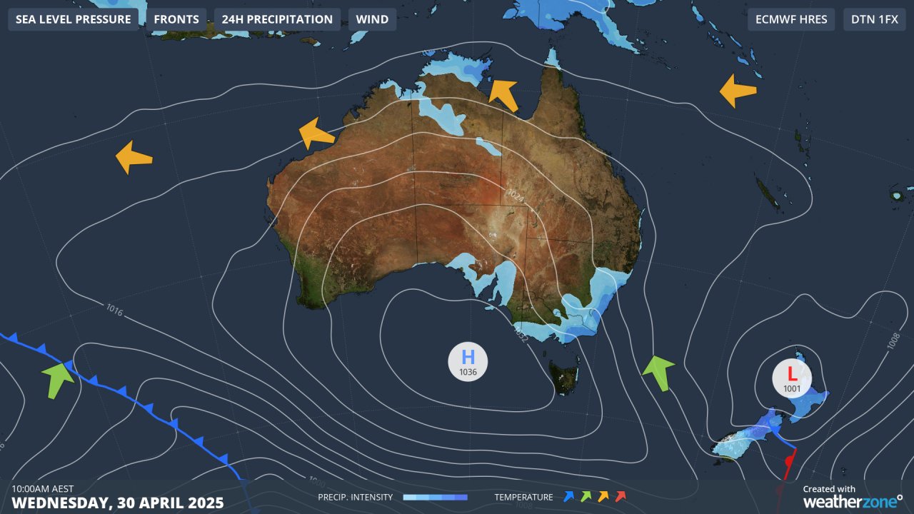
Image: Synoptic image for Wednesday, 30 April.
Follow the warnings and forecast for your region here.
- Other news
- Mon 28 Apr 2025 Wet week ahead for eastern NSW
- Mon 28 Apr 2025 Mesoscale low drenches NSW Hunter, Central Coast regions
- Sat 26 Apr 2025 Severe Weather in SE Australia
- Fri 25 Apr 2025 How weather impacted the original Anzac Day
- Thu 24 Apr 2025 How cold can Canberra get on Anzac Day?