News
‹ back to weather news
News
-
Rain and storms to increase over northern Australia
Ben Domensino, 11 March 2025A late-season surge of tropical moisture will cause an increase in rain and thunderstorms over northern Australia in mid-to-late March, along with an elevated risk of tropical cyclone activity near Australia.
Forecast models predict that an active phase of the Madden-Julian Oscillation (MJO) will pass to the north of Australia during mid-to-late March. When the MJO is active near Australia, it typically causes an increase in clouds, rain and thunderstorms in the tropics.
Rain and thunderstorms are expected to become more active over parts of northern Australia from this weekend into next week. This increased tropical moisture should also contribute to periods of wet and stormy weather over the southern half of Australia in the coming fortnight too.
The map below shows the forecast accumulated rain over the next seven days from the ECMWF model, with wet weather likely to affect part of every state and territory.
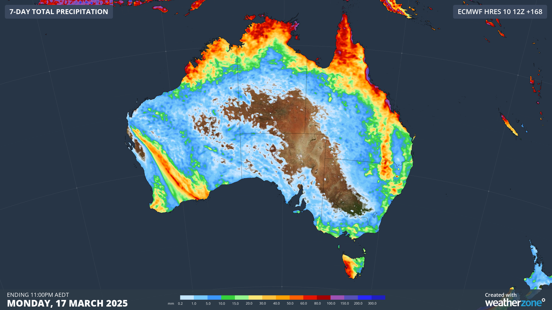
Image: Forecast accumulated rain in the seven days ending at 11pm AEDT on Monday, March 17, 2025.
The presence of the MJO will also boost the likelihood of tropical cyclone activity near northern Australia in the coming fortnight. Some forecast models are already hinting at the potential for a tropical cyclone over the Indian Ocean to the northwest of Australia late next week. It’s too early to know whether this system will form, but meteorologists will be keeping a close eye on the Australian tropics in the coming weeks.
- Other news
- Tue 15 Apr 2025 Rare Sydney Harbour surf on Good Friday
- Mon 14 Apr 2025 Lyrid meteor shower – how to see it from Australia
- Mon 14 Apr 2025 Months of rain in a day in southern WA
- Sun 13 Apr 2025 Boomerang Errol: tropical system could have Kimberley homecoming
- Sat 12 Apr 2025 'Pink moon' to illuminate Australia this weekend