News
‹ back to weather news
News
-
Southern Australia braces for hottest day in over 5 years
Ashleigh Madden, 11 February 2025A searing hot airmass across parts of SA may bring one of the hottest days in half a decade, with strong and gusty winds causing extreme fire danger across multiple states.
Temperatures are set to soar into the mid 40s across large areas of SA on Wednesday and high 30s in Vic on Thursday ahead of a low-pressure system and associated cold front that will move east across the states during the next 72 hours.
The maps below show the scorching heat impacting SA and southwestern Qld on Wednesday, before the heat focusses on Vic and Tas, southwestern Qld and western NSW on Thursday.
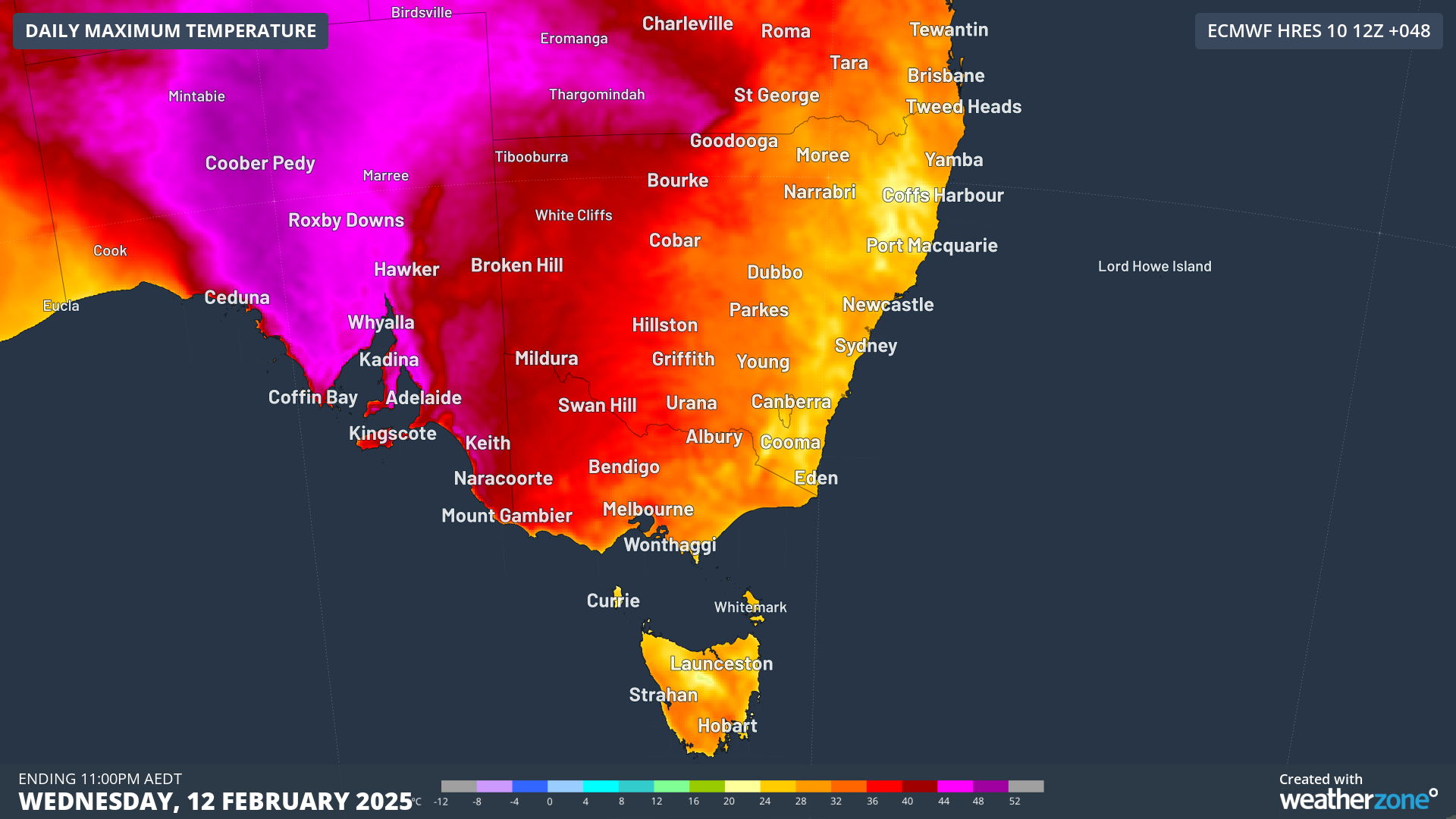
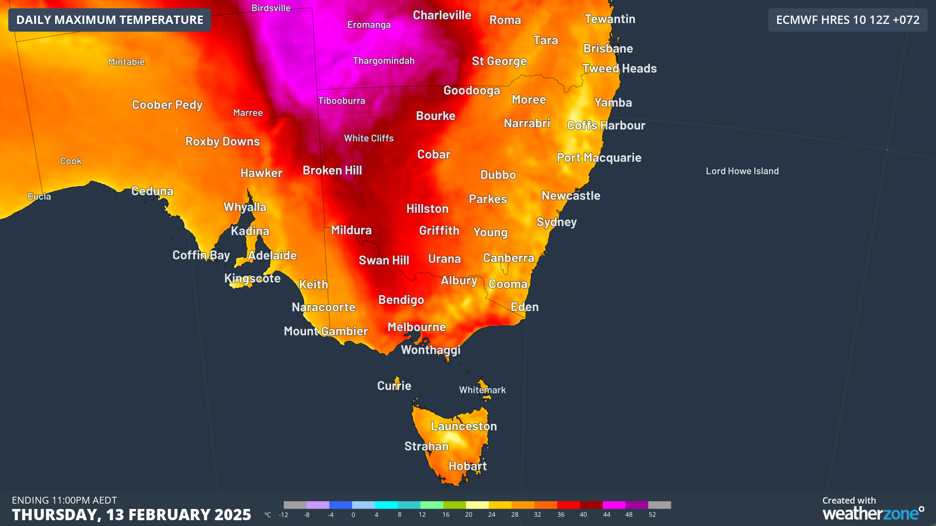
Images: Maximum temperature forecasts for Wednesday, February 12 and Thursday, February 13, according to ECMWF
This heat will impact southeastern capital cities in the coming days:
- Adelaide could see its hottest day since December, 2019, with our forecasters predicting that the temperature could hit 44°C on Wednesday. This scorcher of a day will follow a 39°C day on Tuesday.
- Melbourne should hit 35°C on Wednesday and 37°C on Thursday.
- Hobart’s temperature is forecast to hit the mid 30s on Thursday.
Unfortunately, nighttime temperatures will also be warm, particularly across parts of SA on Tuesday night into Wednesday morning. Adelaide’s temperature is forecast to remain in the mid to high 20s during this period, setting the tone for an extremely hot Wednesday.
The temperature should remain in the 40s at around 6pm local time Wednesday night and should remain in the 30s until midnight, before a cool southerly change arrives.
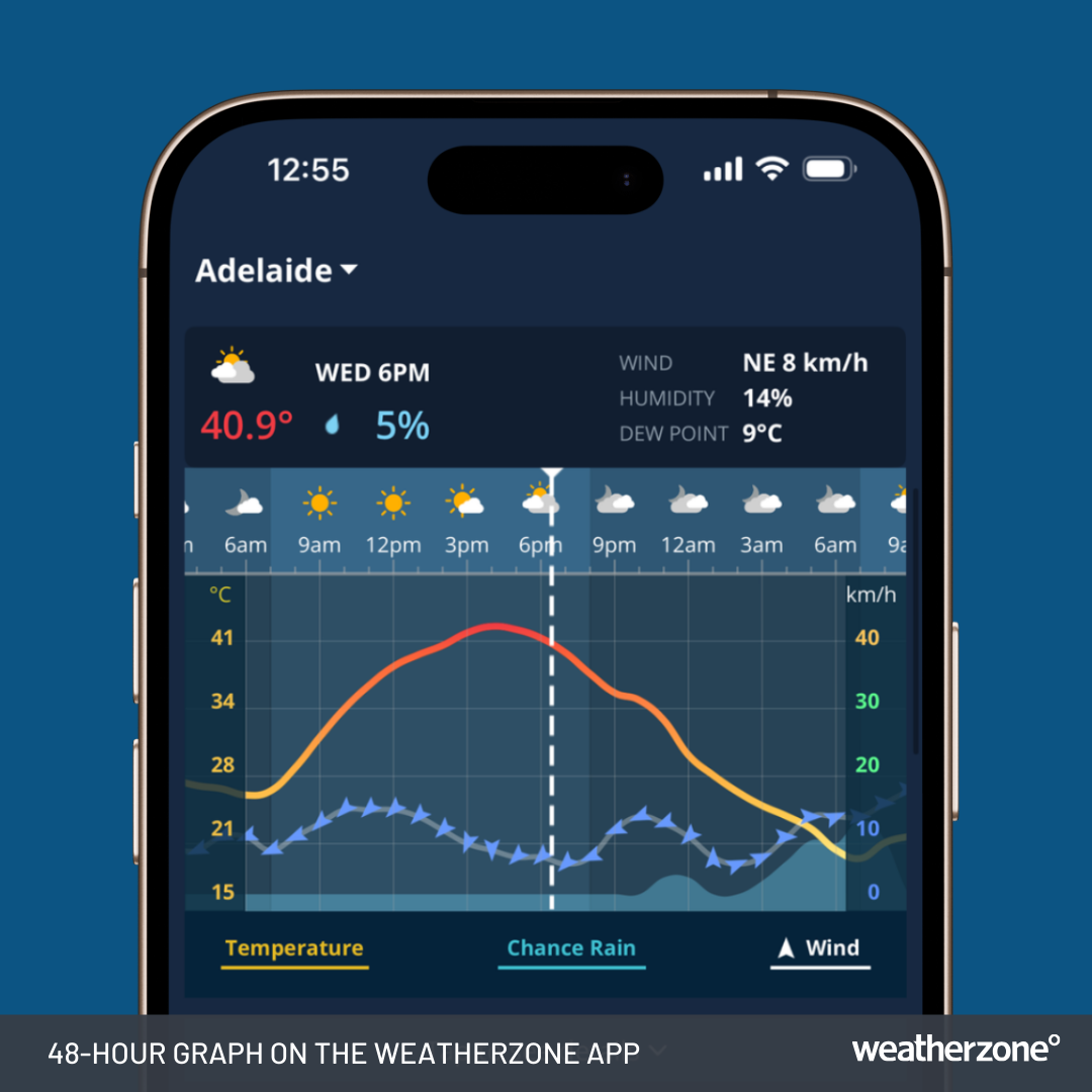
Image: 48-Hour Graph on the Weatherzone app for Adelaide, SA.
Wednesday night will also be warm for Melbourne, with a minimum temperature of 23°C forecast. The temperature will peak in the mid 30s on Thursday ahead of a cool change forecast to sweep across the city in the early evening, providing some relief.
The extremely hot days and uncomfortably warm nights are being caused by hot, strong and gusty northerly winds which will elevate fire danger in the coming days.
Extreme fire danger is forecast for parts of southern SA on Wednesday and the central ranges in Vic on Thursday.
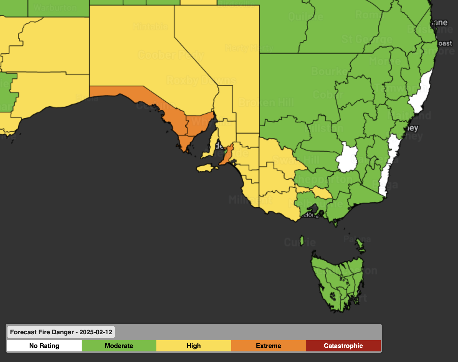
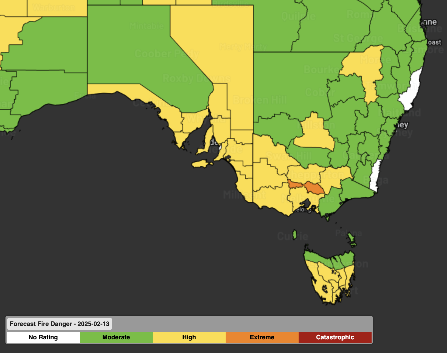
Images: Forecast fire danger for Wednesday and Thursday showing extreme fire danger (orange) in SA and Vic. Source: Bureau of Meteorology
Fortunately, there is a sharp cool change on the horizon with temperatures forecast to drop 5 to 10°C in a matter of hours. The cool change should arrive in Adelaide Wednesday night into Thursday morning, Melbourne early Thursday evening. While the cool change will reduce fire danger across the states, it will provide a challenge for firefighters, with the fire path changing direction and potentially increasing in size.
- Other news
- Tue 11 Feb 2025 'Leave immediately': Tasmanians urged to flee fires
- Tue 11 Feb 2025 Severe tropical cyclone threat looms for WA
- Tue 11 Feb 2025 Queensland deluge continues but drier weather is on the way
- Mon 10 Feb 2025 Cold outbreak brewing with possible summer snow
- Mon 10 Feb 2025 Tropical cyclone to form near Australia this week