News
‹ back to weather news
News
-
Damaging surf battering NSW coast
Ben Domensino, 2 April 2025A powerful swell produced by a bombing low pressure system over the Tasman Sea is causing damaging surf and erosion along the NSW coast today, including parts of Sydney.
The video below shows the Tasman Low spinning around 800km off the NSW coast on Tuesday.
Video: Satellite images showing a deep Tasman Low on Tuesday, April 1, 2025.
This system intensified so rapidly on Monday morning that its central pressure dropped by 20hPa in 24 hours. At this latitude, this was enough for it to be classified as a ‘bomb cyclone’, which is a term used by meteorologists to describe low pressure systems outside the tropics that intensify rapidly over a short period of time (a process called explosive cyclogenesis).
The powerful Tasman Low has caused ferocious winds that have been whipping up massive waves across the Tasman Sea in the last couple of days.
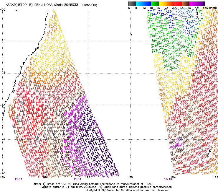
On Monday night, sensors attached to a satellite passing over the Tasman Sea detected a 400km swathe of winds blowing at more than 50 knots (93 km/h) on the western and southern sides of the low’s centre. Satellite data also showed that wave heights on Tuesday morning reached 9.6 metres near this region of storm force winds.

Image: Satellite-detected wind speeds on Monday night. The wind bards with small triangles on their tails show a huge region of winds blowing at more than 50kt (93km/h). Source: NOAA/NESDIS
Closer to Australia’s east coast, significant wave heights of around six metres were also observed near Eden and Port Kembla on Tuesday and Wednesday morning.
These big waves have been causing erosion and damage at some beaches along the NSW coast. In Sydney, Tuesday night’s high tide combined with the pumping surf to cause damage at popular beaches including Bondi and Bronte.
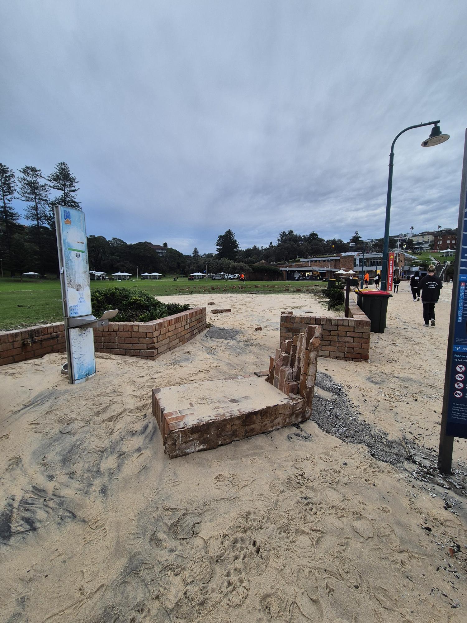
As the sun rose on Wednesday, beachside walkways were covered with sand, walls had been knocked over and the famous Bondi Icebergs pool area had even suffered damage.

Image: A damaged wall at Bronte on Wednesday morning. Source: Krisha Patel
While swell will gradually ease along the NSW coast in the coming days, a hazardous surf warning remains in place on Wednesday for the coast stretching from southern NSW to southeast Qld.
- Other news
- Thu 03 Apr 2025 Why Queensland has been getting all the rain
- Wed 02 Apr 2025 How a West Australian cyclone saturated Queensland
- Tue 01 Apr 2025 Australia's hottest and 4th-wettest March on record
- Tue 01 Apr 2025 Normally dry creek now 60 km wide
- Mon 31 Mar 2025 Powerful bombing Tasman Low brings large waves to NSW

